

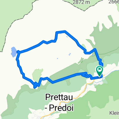
2015 Prettau-Waldner-Tauernalm (13.08.2015)
A cycling route starting in Prettau, Trentino-Alto Adige, Italy.
Overview
About this route
.. von der Tauernalm bergabwärts singletrail
- 3 h 31 min
- Duration
- 22 km
- Distance
- 807 m
- Ascent
- 810 m
- Descent
- 6.3 km/h
- Avg. speed
- ---
- Max. altitude
Continue with Bikemap
Use, edit, or download this cycling route
You would like to ride 2015 Prettau-Waldner-Tauernalm (13.08.2015) or customize it for your own trip? Here is what you can do with this Bikemap route:
Free features
- Save this route as favorite or in collections
- Copy & plan your own version of this route
- Sync your route with Garmin or Wahoo
Premium features
Free trial for 3 days, or one-time payment. More about Bikemap Premium.
- Navigate this route on iOS & Android
- Export a GPX / KML file of this route
- Create your custom printout (try it for free)
- Download this route for offline navigation
Discover more Premium features.
Get Bikemap PremiumFrom our community
Other popular routes starting in Prettau
 Malga Alprechalm
- Distance
- 5.2 km
- Ascent
- 569 m
- Descent
- 20 m
- Location
- Prettau, Trentino-Alto Adige, Italy
 Casere - Rif.Tridentina - Rif.Vetta d'Italia
- Distance
- 19.9 km
- Ascent
- 1,123 m
- Descent
- 1,124 m
- Location
- Prettau, Trentino-Alto Adige, Italy
 Escursione invernale a Steger Alm
- Distance
- 4.2 km
- Ascent
- 507 m
- Descent
- 0 m
- Location
- Prettau, Trentino-Alto Adige, Italy
 Casere - TauernAlm - Rif.Vetta d'Italia
- Distance
- 15.3 km
- Ascent
- 968 m
- Descent
- 966 m
- Location
- Prettau, Trentino-Alto Adige, Italy
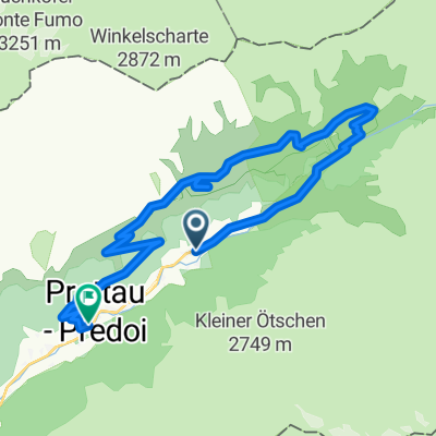
 2015 Prettau-Waldner-Tauernalm (13.08.2015)
- Distance
- 22 km
- Ascent
- 807 m
- Descent
- 810 m
- Location
- Prettau, Trentino-Alto Adige, Italy
 Anello: Casere - Waldnersee
- Distance
- 11.6 km
- Ascent
- 909 m
- Descent
- 906 m
- Location
- Prettau, Trentino-Alto Adige, Italy
 Anello: Predoi - FuchsAlm - TauernAlm - Casere
- Distance
- 15.2 km
- Ascent
- 749 m
- Descent
- 880 m
- Location
- Prettau, Trentino-Alto Adige, Italy
 Prettau -Plätzwiese
- Distance
- 86.5 km
- Ascent
- 2,397 m
- Descent
- 1,862 m
- Location
- Prettau, Trentino-Alto Adige, Italy
Open it in the app