

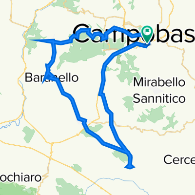
Cb - bocca della selva - Campitello - rivolo - cb
A cycling route starting in Campobasso, Molise, Italy.
Overview
About this route
From CB to Campitello and back.
- -:--
- Duration
- 105.9 km
- Distance
- 1,667 m
- Ascent
- 1,664 m
- Descent
- ---
- Avg. speed
- ---
- Max. altitude
Route quality
Waytypes & surfaces along the route
Waytypes
Road
46.6 km
(44 %)
Quiet road
3.2 km
(3 %)
Surfaces
Paved
21.2 km
(20 %)
Unpaved
1.1 km
(1 %)
Asphalt
21.2 km
(20 %)
Gravel
1.1 km
(1 %)
Undefined
83.7 km
(79 %)
Continue with Bikemap
Use, edit, or download this cycling route
You would like to ride Cb - bocca della selva - Campitello - rivolo - cb or customize it for your own trip? Here is what you can do with this Bikemap route:
Free features
- Save this route as favorite or in collections
- Copy & plan your own version of this route
- Split it into stages to create a multi-day tour
- Sync your route with Garmin or Wahoo
Premium features
Free trial for 3 days, or one-time payment. More about Bikemap Premium.
- Navigate this route on iOS & Android
- Export a GPX / KML file of this route
- Create your custom printout (try it for free)
- Download this route for offline navigation
Discover more Premium features.
Get Bikemap PremiumFrom our community
Other popular routes starting in Campobasso
 Campobasso-Tappino
- Distance
- 8.8 km
- Ascent
- 215 m
- Descent
- 211 m
- Location
- Campobasso, Molise, Italy
 Test 10
- Distance
- 44.9 km
- Ascent
- 1,175 m
- Descent
- 1,173 m
- Location
- Campobasso, Molise, Italy
 campobasso-oratino-montagano-campobasso
- Distance
- 56.8 km
- Ascent
- 875 m
- Descent
- 902 m
- Location
- Campobasso, Molise, Italy
 Giro panoramico per paesi.
- Distance
- 57.6 km
- Ascent
- 982 m
- Descent
- 980 m
- Location
- Campobasso, Molise, Italy
 Itinerario Domenica 20 Luglio 2014 test Granfondo del Matese
- Distance
- 194.8 km
- Ascent
- 2,439 m
- Descent
- 2,708 m
- Location
- Campobasso, Molise, Italy
 R5 Campobasso - Manfredonia
- Distance
- 140.3 km
- Ascent
- 1,142 m
- Descent
- 1,842 m
- Location
- Campobasso, Molise, Italy
 Cb - bocca della selva - Campitello - rivolo - cb
- Distance
- 105.9 km
- Ascent
- 1,667 m
- Descent
- 1,664 m
- Location
- Campobasso, Molise, Italy
 Bosco Faiete e Castello Monforte
- Distance
- 16.3 km
- Ascent
- 494 m
- Descent
- 398 m
- Location
- Campobasso, Molise, Italy
Open it in the app