

Kós Károly Kerékpáros Emlék- és Teljesítménytúra
A cycling route starting in Aghireșu, Cluj County, Romania.
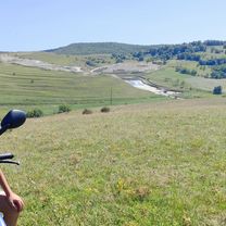
Overview
About this route
A 6. Kolozsvári Magyar Napok keretében idén először hirdeti meg az Erdélyi Kárpát Egyesület – Kolozsvár 1891 a Kós Károly Kerékpáros Emlék- és Teljesítménytúrát, 50, illetve 62/65 km-es távon, augusztus 15-én.
(cloned from route 3213468)- -:--
- Duration
- 60.7 km
- Distance
- 395 m
- Ascent
- 540 m
- Descent
- ---
- Avg. speed
- ---
- Max. altitude
Continue with Bikemap
Use, edit, or download this cycling route
You would like to ride Kós Károly Kerékpáros Emlék- és Teljesítménytúra or customize it for your own trip? Here is what you can do with this Bikemap route:
Free features
- Save this route as favorite or in collections
- Copy & plan your own version of this route
- Sync your route with Garmin or Wahoo
Premium features
Free trial for 3 days, or one-time payment. More about Bikemap Premium.
- Navigate this route on iOS & Android
- Export a GPX / KML file of this route
- Create your custom printout (try it for free)
- Download this route for offline navigation
Discover more Premium features.
Get Bikemap PremiumFrom our community
Other popular routes starting in Aghireșu
 Dealurile Capusului
- Distance
- 45.2 km
- Ascent
- 542 m
- Descent
- 660 m
- Location
- Aghireșu, Cluj County, Romania
 Kós K16_2021
- Distance
- 16.1 km
- Ascent
- 394 m
- Descent
- 502 m
- Location
- Aghireșu, Cluj County, Romania
 DJ108C 211, Leghia - DJ108C 207, Leghia
- Distance
- 62.3 km
- Ascent
- 1,528 m
- Descent
- 1,533 m
- Location
- Aghireșu, Cluj County, Romania
 Tura Tara Calatei - onroad-ish
- Distance
- 35.4 km
- Ascent
- 714 m
- Descent
- 641 m
- Location
- Aghireșu, Cluj County, Romania
 Tura Tara Calatei - offroad
- Distance
- 28.8 km
- Ascent
- 677 m
- Descent
- 603 m
- Location
- Aghireșu, Cluj County, Romania
 Aghiresu - Bedechiu - valea Capusului - Cluj
- Distance
- 61.4 km
- Ascent
- 415 m
- Descent
- 528 m
- Location
- Aghireșu, Cluj County, Romania
 DJ108C 207, Leghia - QGXG+2V, Baciu
- Distance
- 39 km
- Ascent
- 813 m
- Descent
- 844 m
- Location
- Aghireșu, Cluj County, Romania
 Nyugodt útvonal
- Distance
- 16.3 km
- Ascent
- 359 m
- Descent
- 515 m
- Location
- Aghireșu, Cluj County, Romania
Open it in the app