

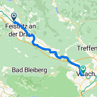
20150815_141936
A cycling route starting in Paternion, Carinthia, Austria.
Overview
About this route
TEASI track
- -:--
- Duration
- 34.8 km
- Distance
- 67 m
- Ascent
- 351 m
- Descent
- ---
- Avg. speed
- ---
- Max. altitude
Route quality
Waytypes & surfaces along the route
Waytypes
Cycleway
16 km
(46 %)
Track
11.1 km
(32 %)
Surfaces
Paved
13.2 km
(38 %)
Unpaved
18.1 km
(52 %)
Asphalt
12.5 km
(36 %)
Loose gravel
11.5 km
(33 %)
Route highlights
Points of interest along the route
Point of interest after 4 km
46°44.793' 13°35.027'
Point of interest after 24.3 km
Gummerner Straße
Continue with Bikemap
Use, edit, or download this cycling route
You would like to ride 20150815_141936 or customize it for your own trip? Here is what you can do with this Bikemap route:
Free features
- Save this route as favorite or in collections
- Copy & plan your own version of this route
- Sync your route with Garmin or Wahoo
Premium features
Free trial for 3 days, or one-time payment. More about Bikemap Premium.
- Navigate this route on iOS & Android
- Export a GPX / KML file of this route
- Create your custom printout (try it for free)
- Download this route for offline navigation
Discover more Premium features.
Get Bikemap PremiumFrom our community
Other popular routes starting in Paternion
 Paternion– Runde um Villach
- Distance
- 57.3 km
- Ascent
- 292 m
- Descent
- 287 m
- Location
- Paternion, Carinthia, Austria
 Paternion - Sankt Jakob
- Distance
- 23.7 km
- Ascent
- 197 m
- Descent
- 225 m
- Location
- Paternion, Carinthia, Austria
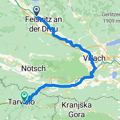 Paternion - Tarvisio
- Distance
- 55.8 km
- Ascent
- 856 m
- Descent
- 637 m
- Location
- Paternion, Carinthia, Austria
 Paternion Runde mit Drauradweg
- Distance
- 32.7 km
- Ascent
- 767 m
- Descent
- 745 m
- Location
- Paternion, Carinthia, Austria
 Paternion Villach Paternion
- Distance
- 66.1 km
- Ascent
- 265 m
- Descent
- 266 m
- Location
- Paternion, Carinthia, Austria
 E3 Feistritz Ferlach
- Distance
- 70.5 km
- Ascent
- 186 m
- Descent
- 273 m
- Location
- Paternion, Carinthia, Austria
 20150815_141936
- Distance
- 34.8 km
- Ascent
- 67 m
- Descent
- 351 m
- Location
- Paternion, Carinthia, Austria
 Nikelsdorf-Gschriet-Fresach-Lansach-Nikelsdorf
- Distance
- 30 km
- Ascent
- 673 m
- Descent
- 699 m
- Location
- Paternion, Carinthia, Austria
Open it in the app