

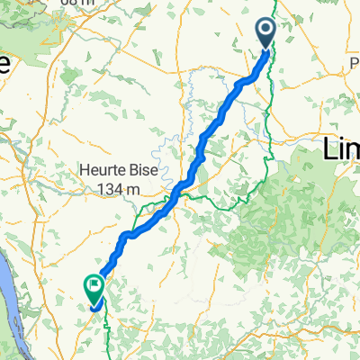
Route langs de Vienne bij Availles - Limouzine
A cycling route starting in Availles-Limouzine, Nouvelle-Aquitaine, France.
Overview
About this route
Length 16 km elevation differences 121 - 199 m
- -:--
- Duration
- 17.2 km
- Distance
- 225 m
- Ascent
- 222 m
- Descent
- ---
- Avg. speed
- ---
- Max. altitude
Route quality
Waytypes & surfaces along the route
Waytypes
Quiet road
8.1 km
(47 %)
Road
2.2 km
(13 %)
Continue with Bikemap
Use, edit, or download this cycling route
You would like to ride Route langs de Vienne bij Availles - Limouzine or customize it for your own trip? Here is what you can do with this Bikemap route:
Free features
- Save this route as favorite or in collections
- Copy & plan your own version of this route
- Sync your route with Garmin or Wahoo
Premium features
Free trial for 3 days, or one-time payment. More about Bikemap Premium.
- Navigate this route on iOS & Android
- Export a GPX / KML file of this route
- Create your custom printout (try it for free)
- Download this route for offline navigation
Discover more Premium features.
Get Bikemap PremiumFrom our community
Other popular routes starting in Availles-Limouzine
 Door to Door Day 9 L'isle-Jourdain - Saint-Jory-de-Chalais 18th Sept
- Distance
- 105.8 km
- Ascent
- 1,350 m
- Descent
- 1,231 m
- Location
- Availles-Limouzine, Nouvelle-Aquitaine, France
 Route langs de Vienne bij Availles - Limouzine
- Distance
- 17.2 km
- Ascent
- 225 m
- Descent
- 222 m
- Location
- Availles-Limouzine, Nouvelle-Aquitaine, France
 L'Isle-Jourdain to Rochechouart
- Distance
- 62.4 km
- Ascent
- 513 m
- Descent
- 381 m
- Location
- Availles-Limouzine, Nouvelle-Aquitaine, France
 Dag 5 Fatima
- Distance
- 153.5 km
- Ascent
- 1,333 m
- Descent
- 1,349 m
- Location
- Availles-Limouzine, Nouvelle-Aquitaine, France
 Availles to Confolens
- Distance
- 35.4 km
- Ascent
- 333 m
- Descent
- 330 m
- Location
- Availles-Limouzine, Nouvelle-Aquitaine, France
 Etape 19 Availles / Mérigny
- Distance
- 75 km
- Ascent
- 612 m
- Descent
- 683 m
- Location
- Availles-Limouzine, Nouvelle-Aquitaine, France
 Rue des Iris 9, Availles-Limouzine to Matelot 6, Availles-Limouzine
- Distance
- 9.5 km
- Ascent
- 0 m
- Descent
- 42 m
- Location
- Availles-Limouzine, Nouvelle-Aquitaine, France
 Le grand villars Bourpeuil
- Distance
- 55.8 km
- Ascent
- 400 m
- Descent
- 399 m
- Location
- Availles-Limouzine, Nouvelle-Aquitaine, France
Open it in the app