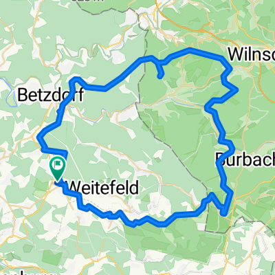
Buchhellertal
A cycling route starting in Elkenroth, Rhineland-Palatinate, Germany.
Overview
About this route
Von Elkenroth über Alsdorf-Herkersdorf-Neunkirchen-Wahlbach-Lippe-Weitefeld zurück nach Elkenroth
- -:--
- Duration
- 56.3 km
- Distance
- 735 m
- Ascent
- 735 m
- Descent
- ---
- Avg. speed
- ---
- Avg. speed
Route quality
Waytypes & surfaces along the route
Waytypes
Track
28.3 km
(50 %)
Quiet road
11.4 km
(20 %)
Surfaces
Paved
14.8 km
(26 %)
Unpaved
30 km
(53 %)
Gravel
14.9 km
(26 %)
Asphalt
9.4 km
(17 %)
Continue with Bikemap
Use, edit, or download this cycling route
You would like to ride Buchhellertal or customize it for your own trip? Here is what you can do with this Bikemap route:
Free features
- Save this route as favorite or in collections
- Copy & plan your own version of this route
- Sync your route with Garmin or Wahoo
Premium features
Free trial for 3 days, or one-time payment. More about Bikemap Premium.
- Navigate this route on iOS & Android
- Export a GPX / KML file of this route
- Create your custom printout (try it for free)
- Download this route for offline navigation
Discover more Premium features.
Get Bikemap PremiumFrom our community
Other popular routes starting in Elkenroth
- Elkenroth Nauberg Nisterberg Elkenroth
- Distance
- 36.6 km
- Ascent
- 360 m
- Descent
- 361 m
- Location
- Elkenroth, Rhineland-Palatinate, Germany
- Elkenroth - Marienstatt - Elkenroth
- Distance
- 26 km
- Ascent
- 454 m
- Descent
- 454 m
- Location
- Elkenroth, Rhineland-Palatinate, Germany
- Buchhellertal
- Distance
- 56.3 km
- Ascent
- 735 m
- Descent
- 735 m
- Location
- Elkenroth, Rhineland-Palatinate, Germany
- Elkenroth - Buchhellertal - Pfannenberg - Druidenstein und zurück
- Distance
- 63 km
- Ascent
- 872 m
- Descent
- 876 m
- Location
- Elkenroth, Rhineland-Palatinate, Germany
- Kleine Runde I
- Distance
- 16.6 km
- Ascent
- 156 m
- Descent
- 156 m
- Location
- Elkenroth, Rhineland-Palatinate, Germany
- Marienberger Straße 8, Elkenroth nach Marienberger Straße 8, Elkenroth
- Distance
- 34.3 km
- Ascent
- 252 m
- Descent
- 246 m
- Location
- Elkenroth, Rhineland-Palatinate, Germany
- Elkenroth - Stegskopf - Elkenroth
- Distance
- 24.1 km
- Ascent
- 271 m
- Descent
- 270 m
- Location
- Elkenroth, Rhineland-Palatinate, Germany
- Mannis Hütte
- Distance
- 12.9 km
- Ascent
- 211 m
- Descent
- 212 m
- Location
- Elkenroth, Rhineland-Palatinate, Germany
Open it in the app