

Vuelta por Arenas de Cabrales
A cycling route starting in Carreña, Principality of Asturias, Spain.
Overview
About this route
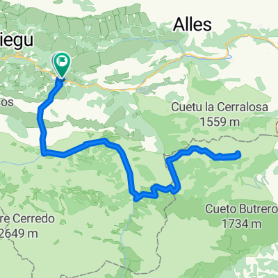
Vuelta por Arenas de Cabrales, subiendo a Sotres
- -:--
- Duration
- 73 km
- Distance
- 1,716 m
- Ascent
- 1,721 m
- Descent
- ---
- Avg. speed
- ---
- Max. altitude

Route quality
Waytypes & surfaces along the route
Waytypes
Busy road
56 km
(77 %)
Road
15.8 km
(22 %)
Surfaces
Paved
72.7 km
(100 %)
Asphalt
72.7 km
(100 %)
Paving stones
0 km
(<1 %)
Undefined
0.2 km
(<1 %)
Continue with Bikemap
Use, edit, or download this cycling route
You would like to ride Vuelta por Arenas de Cabrales or customize it for your own trip? Here is what you can do with this Bikemap route:
Free features
- Save this route as favorite or in collections
- Copy & plan your own version of this route
- Sync your route with Garmin or Wahoo
Premium features
Free trial for 3 days, or one-time payment. More about Bikemap Premium.
- Navigate this route on iOS & Android
- Export a GPX / KML file of this route
- Create your custom printout (try it for free)
- Download this route for offline navigation
Discover more Premium features.
Get Bikemap PremiumFrom our community
Other popular routes starting in Carreña
 Vuelta por Arenas de Cabrales
- Distance
- 73 km
- Ascent
- 1,716 m
- Descent
- 1,721 m
- Location
- Carreña, Principality of Asturias, Spain
 picos de europa... pero no
- Distance
- 209.8 km
- Ascent
- 2,684 m
- Descent
- 2,690 m
- Location
- Carreña, Principality of Asturias, Spain
 Circular Macizo Central Picos de Europa
- Distance
- 63.1 km
- Ascent
- 3,116 m
- Descent
- 3,116 m
- Location
- Carreña, Principality of Asturias, Spain
 Jito Escarandi
- Distance
- 57.5 km
- Ascent
- 1,663 m
- Descent
- 1,658 m
- Location
- Carreña, Principality of Asturias, Spain
 Cares d2
- Distance
- 56.4 km
- Ascent
- 1,316 m
- Descent
- 1,442 m
- Location
- Carreña, Principality of Asturias, Spain
 JITO de ESCARANDI, por Poncebos
- Distance
- 14.8 km
- Ascent
- 1,242 m
- Descent
- 145 m
- Location
- Carreña, Principality of Asturias, Spain
 Arenas de Cabrales - Potes
- Distance
- 47.2 km
- Ascent
- 469 m
- Descent
- 332 m
- Location
- Carreña, Principality of Asturias, Spain
 9ª Etapa Ibérica 2015
- Distance
- 163.4 km
- Ascent
- 2,684 m
- Descent
- 936 m
- Location
- Carreña, Principality of Asturias, Spain
Open it in the app