

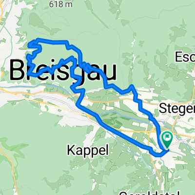
Höfen-Höfener Hütte-Titisee-Eisweier-Ödenbach-Höfen
A cycling route starting in Kirchzarten, Baden-Württemberg, Germany.
Overview
About this route
Höfen-Höfener Hütte-Titisee-Eisweier-Ödenbach-Höfen
- -:--
- Duration
- 45.1 km
- Distance
- 1,177 m
- Ascent
- 1,179 m
- Descent
- ---
- Avg. speed
- ---
- Max. altitude
Route quality
Waytypes & surfaces along the route
Waytypes
Track
18.8 km
(42 %)
Quiet road
13.3 km
(30 %)
Surfaces
Paved
24 km
(53 %)
Unpaved
20.4 km
(45 %)
Asphalt
23.8 km
(53 %)
Gravel
9.7 km
(22 %)
Continue with Bikemap
Use, edit, or download this cycling route
You would like to ride Höfen-Höfener Hütte-Titisee-Eisweier-Ödenbach-Höfen or customize it for your own trip? Here is what you can do with this Bikemap route:
Free features
- Save this route as favorite or in collections
- Copy & plan your own version of this route
- Sync your route with Garmin or Wahoo
Premium features
Free trial for 3 days, or one-time payment. More about Bikemap Premium.
- Navigate this route on iOS & Android
- Export a GPX / KML file of this route
- Create your custom printout (try it for free)
- Download this route for offline navigation
Discover more Premium features.
Get Bikemap PremiumFrom our community
Other popular routes starting in Kirchzarten
 Kleine Sternwald Tour die Dritte
- Distance
- 28.5 km
- Ascent
- 919 m
- Descent
- 940 m
- Location
- Kirchzarten, Baden-Württemberg, Germany
 Route Black Forest Ultra Bike (ULTRA - 116 km)
- Distance
- 109.8 km
- Ascent
- 2,198 m
- Descent
- 2,190 m
- Location
- Kirchzarten, Baden-Württemberg, Germany
 Tunibergrunde
- Distance
- 64.6 km
- Ascent
- 230 m
- Descent
- 230 m
- Location
- Kirchzarten, Baden-Württemberg, Germany
 Freiburg trail 2017-10-15
- Distance
- 26.2 km
- Ascent
- 710 m
- Descent
- 783 m
- Location
- Kirchzarten, Baden-Württemberg, Germany
 2/3 vom Marathon beim Black Forest Bike Marathon
- Distance
- 40.7 km
- Ascent
- 1,273 m
- Descent
- 1,273 m
- Location
- Kirchzarten, Baden-Württemberg, Germany
 Kandel + Thurner
- Distance
- 78.5 km
- Ascent
- 1,998 m
- Descent
- 1,999 m
- Location
- Kirchzarten, Baden-Württemberg, Germany
 Nette Samstagsrunde
- Distance
- 91.2 km
- Ascent
- 2,638 m
- Descent
- 2,582 m
- Location
- Kirchzarten, Baden-Württemberg, Germany
 Wendelinskappele - St.Ottilientour
- Distance
- 25.3 km
- Ascent
- 513 m
- Descent
- 512 m
- Location
- Kirchzarten, Baden-Württemberg, Germany
Open it in the app