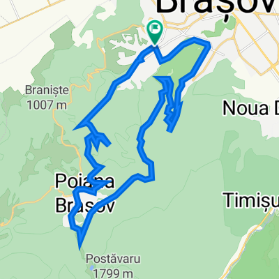
De la Brasov la Bran
A cycling route starting in Braşov, Judeţul Braşov, Romania.
Overview
About this route
Variantă off-road de a ajunge din Brașov la Bran, traseu recomandat bicicletelor MTB pentru că se merge pe drumuri pitruite, drumuri de căruță și poteci. Traseul îl găsiți și pe www.ciclotrasee.ro/brasovbran
- -:--
- Duration
- 40.2 km
- Distance
- 538 m
- Ascent
- 364 m
- Descent
- ---
- Avg. speed
- ---
- Avg. speed
Route quality
Waytypes & surfaces along the route
Waytypes
Quiet road
17.2 km
(43 %)
Road
8.6 km
(21 %)
Surfaces
Paved
23.3 km
(58 %)
Unpaved
14.3 km
(36 %)
Asphalt
21.9 km
(54 %)
Gravel
8.6 km
(21 %)
Continue with Bikemap
Use, edit, or download this cycling route
You would like to ride De la Brasov la Bran or customize it for your own trip? Here is what you can do with this Bikemap route:
Free features
- Save this route as favorite or in collections
- Copy & plan your own version of this route
- Sync your route with Garmin or Wahoo
Premium features
Free trial for 3 days, or one-time payment. More about Bikemap Premium.
- Navigate this route on iOS & Android
- Export a GPX / KML file of this route
- Create your custom printout (try it for free)
- Download this route for offline navigation
Discover more Premium features.
Get Bikemap PremiumFrom our community
Other popular routes starting in Braşov
- 13apr2025 Brașov
- Distance
- 31.3 km
- Ascent
- 881 m
- Descent
- 924 m
- Location
- Braşov, Judeţul Braşov, Romania
- Recorded via Apple Watch on 11 May at 11:59
- Distance
- 19.8 km
- Ascent
- 400 m
- Descent
- 400 m
- Location
- Braşov, Judeţul Braşov, Romania
- Valea cu apa din Saua Tampei 09.07.2013
- Distance
- 18 km
- Ascent
- 726 m
- Descent
- 728 m
- Location
- Braşov, Judeţul Braşov, Romania
- Recorded via Apple Watch on 02 May at 12:33
- Distance
- 12 km
- Ascent
- 176 m
- Descent
- 176 m
- Location
- Braşov, Judeţul Braşov, Romania
- Brasov - Sf. Gheorghe - Baraolt - Brasov
- Distance
- 127.4 km
- Ascent
- 2,118 m
- Descent
- 1,577 m
- Location
- Braşov, Judeţul Braşov, Romania
- Recorded via Apple Watch on 03 May at 11:58
- Distance
- 20.5 km
- Ascent
- 432 m
- Descent
- 424 m
- Location
- Braşov, Judeţul Braşov, Romania
- Blumana-Solomon-Valea cu apă-La Bancuță-Iepure-Sub Tâmpa-Blumăna
- Distance
- 20 km
- Ascent
- 943 m
- Descent
- 882 m
- Location
- Braşov, Judeţul Braşov, Romania
- Traseu MTB Hobby - Duatlon 2009
- Distance
- 11.5 km
- Ascent
- 696 m
- Descent
- 687 m
- Location
- Braşov, Judeţul Braşov, Romania
Open it in the app