

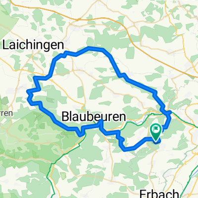
ronde blaubeuren
A cycling route starting in Erbach, Baden-Wurttemberg, Germany.
Overview
About this route
- -:--
- Duration
- 60.9 km
- Distance
- 606 m
- Ascent
- 606 m
- Descent
- ---
- Avg. speed
- ---
- Max. altitude
Continue with Bikemap
Use, edit, or download this cycling route
You would like to ride ronde blaubeuren or customize it for your own trip? Here is what you can do with this Bikemap route:
Free features
- Save this route as favorite or in collections
- Copy & plan your own version of this route
- Sync your route with Garmin or Wahoo
Premium features
Free trial for 3 days, or one-time payment. More about Bikemap Premium.
- Navigate this route on iOS & Android
- Export a GPX / KML file of this route
- Create your custom printout (try it for free)
- Download this route for offline navigation
Discover more Premium features.
Get Bikemap PremiumFrom our community
Other popular routes starting in Erbach
 Alb-Donautal Radtour
- Distance
- 76.4 km
- Ascent
- 1,480 m
- Descent
- 1,516 m
- Location
- Erbach, Baden-Wurttemberg, Germany
 Dellmensingen - Laupheim - Dietenheim - Dellmensingen
- Distance
- 74.4 km
- Ascent
- 364 m
- Descent
- 365 m
- Location
- Erbach, Baden-Wurttemberg, Germany
 ronde blaubeuren
- Distance
- 60.9 km
- Ascent
- 606 m
- Descent
- 606 m
- Location
- Erbach, Baden-Wurttemberg, Germany
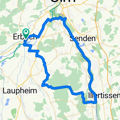
 Erbach - Illertissen - Iller entlang - Erbach
- Distance
- 61.5 km
- Ascent
- 213 m
- Descent
- 212 m
- Location
- Erbach, Baden-Wurttemberg, Germany
 MTB Feierabendrunde
- Distance
- 28.6 km
- Ascent
- 400 m
- Descent
- 397 m
- Location
- Erbach, Baden-Wurttemberg, Germany
 Tour Einsingen
- Distance
- 40.9 km
- Ascent
- 458 m
- Descent
- 458 m
- Location
- Erbach, Baden-Wurttemberg, Germany
 Erbach - Illertissen - Iller entlang - Erbach
- Distance
- 61.5 km
- Ascent
- 185 m
- Descent
- 182 m
- Location
- Erbach, Baden-Wurttemberg, Germany
 Dellmensingen Feierabend 30km
- Distance
- 31.2 km
- Ascent
- 54 m
- Descent
- 54 m
- Location
- Erbach, Baden-Wurttemberg, Germany
Open it in the app