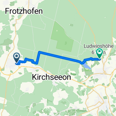
Zorneding-Villach
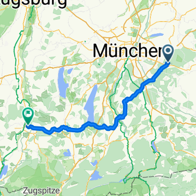
A cycling route starting in Zorneding, Bavaria, Germany.
Overview
About this route
with 3 overnight stays :
Waginger See
Golling
St. Michael<br />
with Tauern and Murradweg (parts) on bike paths around Salzburg
Ascents :
Roßfeld
Obertauern
Flattnitz
- -:--
- Duration
- 403.9 km
- Distance
- 2,654 m
- Ascent
- 2,672 m
- Descent
- ---
- Avg. speed
- ---
- Max. altitude
Route highlights
Points of interest along the route
Point of interest after 128.4 km
1. Übernachtung Zeltplatz Kühnhausen
Point of interest after 197.6 km
2. Übernachtung Pension "all-inclusive"
Point of interest after 326.4 km
3. Übernachtung Gasthof
Continue with Bikemap
Use, edit, or download this cycling route
You would like to ride Zorneding-Villach or customize it for your own trip? Here is what you can do with this Bikemap route:
Free features
- Save this route as favorite or in collections
- Copy & plan your own version of this route
- Split it into stages to create a multi-day tour
- Sync your route with Garmin or Wahoo
Premium features
Free trial for 3 days, or one-time payment. More about Bikemap Premium.
- Navigate this route on iOS & Android
- Export a GPX / KML file of this route
- Create your custom printout (try it for free)
- Download this route for offline navigation
Discover more Premium features.
Get Bikemap PremiumFrom our community
Other popular routes starting in Zorneding
- Piusheim
- Distance
- 58.2 km
- Ascent
- 364 m
- Descent
- 368 m
- Location
- Zorneding, Bavaria, Germany
- Zorneding-Großhelfendorf
- Distance
- 64.2 km
- Ascent
- 650 m
- Descent
- 649 m
- Location
- Zorneding, Bavaria, Germany
- Zorneding-Villach
- Distance
- 403.9 km
- Ascent
- 2,654 m
- Descent
- 2,672 m
- Location
- Zorneding, Bavaria, Germany
- Zorneding-Hohenlinden
- Distance
- 62.8 km
- Ascent
- 571 m
- Descent
- 571 m
- Location
- Zorneding, Bavaria, Germany
- Schnelle Runde Zorneding - Aßling - G'höhenrain
- Distance
- 45.6 km
- Ascent
- 576 m
- Descent
- 566 m
- Location
- Zorneding, Bavaria, Germany
- Erding
- Distance
- 63.8 km
- Ascent
- 127 m
- Descent
- 127 m
- Location
- Zorneding, Bavaria, Germany
- Panorama-Route bayr. Oberland
- Distance
- 55.8 km
- Ascent
- 630 m
- Descent
- 600 m
- Location
- Zorneding, Bavaria, Germany
- Zorneding-Unterelkhofen
- Distance
- 57.1 km
- Ascent
- 350 m
- Descent
- 350 m
- Location
- Zorneding, Bavaria, Germany
Open it in the app