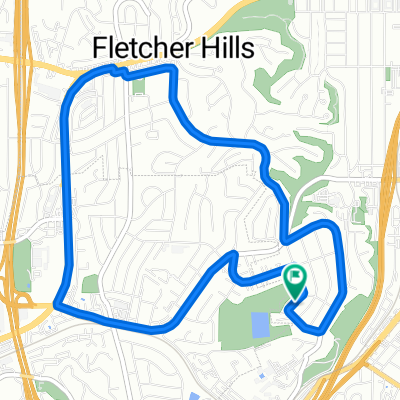
Aug 17, 2015, 6:24 PM
A cycling route starting in El Cajon, California, United States of America.
Overview
About this route
8/17/15, 6:24 PM
- -:--
- Duration
- 30 km
- Distance
- 319 m
- Ascent
- 316 m
- Descent
- ---
- Avg. speed
- ---
- Avg. speed
Route quality
Waytypes & surfaces along the route
Waytypes
Road
11.7 km
(39 %)
Quiet road
10.2 km
(34 %)
Surfaces
Paved
21 km
(70 %)
Asphalt
20.8 km
(69 %)
Concrete
0.2 km
(<1 %)
Undefined
9 km
(30 %)
Continue with Bikemap
Use, edit, or download this cycling route
You would like to ride Aug 17, 2015, 6:24 PM or customize it for your own trip? Here is what you can do with this Bikemap route:
Free features
- Save this route as favorite or in collections
- Copy & plan your own version of this route
- Sync your route with Garmin or Wahoo
Premium features
Free trial for 3 days, or one-time payment. More about Bikemap Premium.
- Navigate this route on iOS & Android
- Export a GPX / KML file of this route
- Create your custom printout (try it for free)
- Download this route for offline navigation
Discover more Premium features.
Get Bikemap PremiumFrom our community
Other popular routes starting in El Cajon
- Aug 17, 2015, 6:24 PM
- Distance
- 30 km
- Ascent
- 319 m
- Descent
- 316 m
- Location
- El Cajon, California, United States of America
- bike run
- Distance
- 8.6 km
- Ascent
- 27 m
- Descent
- 25 m
- Location
- El Cajon, California, United States of America
- Washington Heights Road 851, El Cajon to West 19th Street 647-699, Yuma
- Distance
- 281.8 km
- Ascent
- 2,632 m
- Descent
- 2,743 m
- Location
- El Cajon, California, United States of America
- South Lincoln Avenue 649, El Cajon to Fletcher Parkway 175, El Cajon
- Distance
- 4.7 km
- Ascent
- 30 m
- Descent
- 43 m
- Location
- El Cajon, California, United States of America
- Transit-Viejas climb
- Distance
- 38.8 km
- Ascent
- 954 m
- Descent
- 101 m
- Location
- El Cajon, California, United States of America
- figure 8
- Distance
- 16.4 km
- Ascent
- 63 m
- Descent
- 61 m
- Location
- El Cajon, California, United States of America
- Ferdinand Road 2531, El Cajon to Ferdinand Road 2537, El Cajon
- Distance
- 20.1 km
- Ascent
- 237 m
- Descent
- 237 m
- Location
- El Cajon, California, United States of America
- break down
- Distance
- 12.1 km
- Ascent
- 98 m
- Descent
- 95 m
- Location
- El Cajon, California, United States of America
Open it in the app