

Lößnitz-Spiegelwald-Szb-Lößnitz
A cycling route starting in Lößnitz, Saxony, Germany.
Overview
About this route
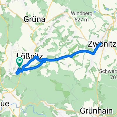
From Lößnitz to Grünhain (Spiegelwald Tower), it goes steadily uphill, mainly through forests and residential areas. From there, first on gravel, to the main road and then (at 60 km/h) into the valley. On side roads and forest paths, we then rode on almost flat terrain, first to Lauter and then to Aue. And finally, we arrived in Lößnitz via Alperoda.
- -:--
- Duration
- 30.8 km
- Distance
- 544 m
- Ascent
- 544 m
- Descent
- ---
- Avg. speed
- ---
- Max. altitude

Continue with Bikemap
Use, edit, or download this cycling route
You would like to ride Lößnitz-Spiegelwald-Szb-Lößnitz or customize it for your own trip? Here is what you can do with this Bikemap route:
Free features
- Save this route as favorite or in collections
- Copy & plan your own version of this route
- Sync your route with Garmin or Wahoo
Premium features
Free trial for 3 days, or one-time payment. More about Bikemap Premium.
- Navigate this route on iOS & Android
- Export a GPX / KML file of this route
- Create your custom printout (try it for free)
- Download this route for offline navigation
Discover more Premium features.
Get Bikemap PremiumFrom our community
Other popular routes starting in Lößnitz
 Tour über Katzenstein
- Distance
- 17.8 km
- Ascent
- 332 m
- Descent
- 332 m
- Location
- Lößnitz, Saxony, Germany
 Lößnitz -> Greifenbachstauweiher
- Distance
- 20.7 km
- Ascent
- 492 m
- Descent
- 286 m
- Location
- Lößnitz, Saxony, Germany
 Forum
Forum- Distance
- 10.8 km
- Ascent
- 162 m
- Descent
- 159 m
- Location
- Lößnitz, Saxony, Germany
 Arbeitsweg H
- Distance
- 17.6 km
- Ascent
- 264 m
- Descent
- 267 m
- Location
- Lößnitz, Saxony, Germany
 Arzgebirg
- Distance
- 141 km
- Ascent
- 2,003 m
- Descent
- 2,003 m
- Location
- Lößnitz, Saxony, Germany
 Lößnitz-Spiegelwald-Szb-Lößnitz
- Distance
- 30.8 km
- Ascent
- 544 m
- Descent
- 544 m
- Location
- Lößnitz, Saxony, Germany
 Ausflug nach Tschechien und Fichtelberg
- Distance
- 94.3 km
- Ascent
- 1,038 m
- Descent
- 1,038 m
- Location
- Lößnitz, Saxony, Germany
 Lößnitz - Stollberg - Zwönitz - Lößnitz
- Distance
- 32 km
- Ascent
- 411 m
- Descent
- 411 m
- Location
- Lößnitz, Saxony, Germany
Open it in the app