

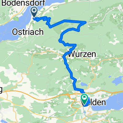
Gerlitzen summit to Annenheim camping
A cycling route starting in Ossiach, Carinthia, Austria.
Overview
About this route
Beginning very steep with loose stones (only approx. 100m), then gravel, then paved road from Kanzelhohe to the camping.
- -:--
- Duration
- 19.4 km
- Distance
- 76 m
- Ascent
- 1,474 m
- Descent
- ---
- Avg. speed
- ---
- Max. altitude
Continue with Bikemap
Use, edit, or download this cycling route
You would like to ride Gerlitzen summit to Annenheim camping or customize it for your own trip? Here is what you can do with this Bikemap route:
Free features
- Save this route as favorite or in collections
- Copy & plan your own version of this route
- Sync your route with Garmin or Wahoo
Premium features
Free trial for 3 days, or one-time payment. More about Bikemap Premium.
- Navigate this route on iOS & Android
- Export a GPX / KML file of this route
- Create your custom printout (try it for free)
- Download this route for offline navigation
Discover more Premium features.
Get Bikemap PremiumFrom our community
Other popular routes starting in Ossiach
 Ossiacher Wald Wander Weg Lauf
- Distance
- 6.8 km
- Ascent
- 163 m
- Descent
- 163 m
- Location
- Ossiach, Carinthia, Austria
 E-Bike Tour Ossiach - Velden - Nr. 11
- Distance
- 18.5 km
- Ascent
- 689 m
- Descent
- 748 m
- Location
- Ossiach, Carinthia, Austria
 Ossiachersee/Bodensdorf-Faakersee-über die Drau zurück
- Distance
- 55.1 km
- Ascent
- 483 m
- Descent
- 490 m
- Location
- Ossiach, Carinthia, Austria
 Sattendorf - Moosburg - Sattendorf 2
- Distance
- 71.1 km
- Ascent
- 539 m
- Descent
- 542 m
- Location
- Ossiach, Carinthia, Austria
 Von Ossiach bis Spittal an der Drau
- Distance
- 112.7 km
- Ascent
- 857 m
- Descent
- 858 m
- Location
- Ossiach, Carinthia, Austria
 Steindorf - Pobersach - Steindorf/Bodensdorf (Hotelroute3)
- Distance
- 66.5 km
- Ascent
- 434 m
- Descent
- 438 m
- Location
- Ossiach, Carinthia, Austria
 Rund um den Ossiacher See
- Distance
- 42 km
- Ascent
- 1,032 m
- Descent
- 1,031 m
- Location
- Ossiach, Carinthia, Austria
 Ossiacher See - Wörther See
- Distance
- 71 km
- Ascent
- 401 m
- Descent
- 401 m
- Location
- Ossiach, Carinthia, Austria
Open it in the app