

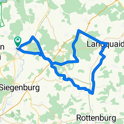
Kelheim - Geisenfeld
A cycling route starting in Abensberg, Bavaria, Germany.
Overview
About this route
Von Kelheim nach Geisenfeld durch den Dürnbucher Forst (cloned from route 3060664)
- -:--
- Duration
- 36.1 km
- Distance
- 201 m
- Ascent
- 209 m
- Descent
- ---
- Avg. speed
- ---
- Max. altitude
Route quality
Waytypes & surfaces along the route
Waytypes
Track
23.3 km
(65 %)
Road
4.7 km
(13 %)
Surfaces
Paved
4.1 km
(11 %)
Unpaved
21.5 km
(60 %)
Gravel
13.4 km
(37 %)
Unpaved (undefined)
3.4 km
(9 %)
Continue with Bikemap
Use, edit, or download this cycling route
You would like to ride Kelheim - Geisenfeld or customize it for your own trip? Here is what you can do with this Bikemap route:
Free features
- Save this route as favorite or in collections
- Copy & plan your own version of this route
- Sync your route with Garmin or Wahoo
Premium features
Free trial for 3 days, or one-time payment. More about Bikemap Premium.
- Navigate this route on iOS & Android
- Export a GPX / KML file of this route
- Create your custom printout (try it for free)
- Download this route for offline navigation
Discover more Premium features.
Get Bikemap PremiumFrom our community
Other popular routes starting in Abensberg
 Abenstal-Holledau-Tour mit Mainburg und Attenhofen
- Distance
- 61 km
- Ascent
- 675 m
- Descent
- 670 m
- Location
- Abensberg, Bavaria, Germany
 Ho3: Abensberg - Pfaffenhofen a.d. Ilm, 76,6km, 332hm
- Distance
- 76.6 km
- Ascent
- 332 m
- Descent
- 277 m
- Location
- Abensberg, Bavaria, Germany
 Prag Tag 2
- Distance
- 103.9 km
- Ascent
- 718 m
- Descent
- 736 m
- Location
- Abensberg, Bavaria, Germany
 Abenstal-Holledau-Tour kurz
- Distance
- 49.7 km
- Ascent
- 475 m
- Descent
- 473 m
- Location
- Abensberg, Bavaria, Germany
 Abensberg-Saal an der Donau-Riedenburg-Altmannstein-Abensberg
- Distance
- 70.7 km
- Ascent
- 228 m
- Descent
- 225 m
- Location
- Abensberg, Bavaria, Germany
 ABENSBERG KELHEIM
- Distance
- 16.4 km
- Ascent
- 66 m
- Descent
- 82 m
- Location
- Abensberg, Bavaria, Germany
 Abensberg ingolstadt
- Distance
- 37.3 km
- Ascent
- 29 m
- Descent
- 26 m
- Location
- Abensberg, Bavaria, Germany
 Rundtour um Abensberg
- Distance
- 53.2 km
- Ascent
- 438 m
- Descent
- 422 m
- Location
- Abensberg, Bavaria, Germany
Open it in the app