

Carpentras - Mont Ventoux - Carpentras
A cycling route starting in Carpentras, Provence-Alpes-Côte d'Azur Region, France.
Overview
About this route
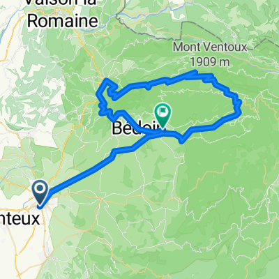
Rundkurs von Carpentras durch die Gorges de la Nesque auf den Mont Ventoux. Von Carpentras auf der D 942 zunächst nach Manzan und weiter nach Villes sur Auzon. Dort beginnt die Gorges de la Nesque. Die Schlucht wird auf einer Länge von 19,5 km durchfahren, dabei werden 444 hm überwunden. Am Ende der Schlucht, am Aussichtspunkt "Belvedere" hat man einen schönen Ausblick in die Schlucht und auf den Mont Ventoux. Weiter geht es über Monieux nach Sault. Dort beginnt die 26 km lange Ostrampe auf den Mont Ventoux. In Sault gibt es nochmal die Möglichkeit sich zu verpflegen. Auf der D 164 geht es bis zur Einmündung in die D 974 am Chalet Reynard. Von dort sind es noch 6 km auf den Gipfel. Abfahrt nach Malaucene. Über die D 938 gehrt es zurück zum Ausgangspunkt in Carpentras.
- -:--
- Duration
- 111.4 km
- Distance
- 1,943 m
- Ascent
- 1,943 m
- Descent
- ---
- Avg. speed
- ---
- Max. altitude

Route quality
Waytypes & surfaces along the route
Waytypes
Busy road
76.4 km
(69 %)
Road
25.1 km
(23 %)
Surfaces
Paved
96.7 km
(87 %)
Unpaved
0.1 km
(<1 %)
Asphalt
96.5 km
(87 %)
Concrete
0.2 km
(<1 %)
Continue with Bikemap
Use, edit, or download this cycling route
You would like to ride Carpentras - Mont Ventoux - Carpentras or customize it for your own trip? Here is what you can do with this Bikemap route:
Free features
- Save this route as favorite or in collections
- Copy & plan your own version of this route
- Split it into stages to create a multi-day tour
- Sync your route with Garmin or Wahoo
Premium features
Free trial for 3 days, or one-time payment. More about Bikemap Premium.
- Navigate this route on iOS & Android
- Export a GPX / KML file of this route
- Create your custom printout (try it for free)
- Download this route for offline navigation
Discover more Premium features.
Get Bikemap PremiumFrom our community
Other popular routes starting in Carpentras
 carpentras-maulacene-mou ventoux-bèdoin-carpentras
- Distance
- 79.4 km
- Ascent
- 1,859 m
- Descent
- 1,877 m
- Location
- Carpentras, Provence-Alpes-Côte d'Azur Region, France
 10. Tag Carpentras - Avignon
- Distance
- 93.5 km
- Ascent
- 718 m
- Descent
- 797 m
- Location
- Carpentras, Provence-Alpes-Côte d'Azur Region, France
 Carpentras-Gordes-..
- Distance
- 70.8 km
- Ascent
- 664 m
- Descent
- 665 m
- Location
- Carpentras, Provence-Alpes-Côte d'Azur Region, France
 ''Vélocio - Mt Ventoux" - Gorges de la Nesque - 16 Juin 18 - Y.P.
- Distance
- 183 km
- Ascent
- 2,563 m
- Descent
- 2,564 m
- Location
- Carpentras, Provence-Alpes-Côte d'Azur Region, France
 Alpen/Provence 2018 - 8. Tag
- Distance
- 129.4 km
- Ascent
- 754 m
- Descent
- 772 m
- Location
- Carpentras, Provence-Alpes-Côte d'Azur Region, France
 2. Radetappe Luberon - Camargue
- Distance
- 43.4 km
- Ascent
- 724 m
- Descent
- 512 m
- Location
- Carpentras, Provence-Alpes-Côte d'Azur Region, France
 Mont Ventoux
- Distance
- 73.4 km
- Ascent
- 1,834 m
- Descent
- 1,818 m
- Location
- Carpentras, Provence-Alpes-Côte d'Azur Region, France
 1. Etappe Carpentras-Ventoux-Bedoin
- Distance
- 71.8 km
- Ascent
- 2,012 m
- Descent
- 1,682 m
- Location
- Carpentras, Provence-Alpes-Côte d'Azur Region, France
Open it in the app