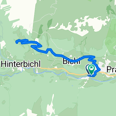
Prägraten-Johannishütte
- 7.2 km
- 805 m
- 18 m
- Virgen, Tyrol, Austria
A cycling route starting in Virgen, Tyrol, Austria.
Overview
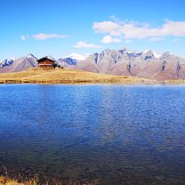
Hiking Trail
Duration: Timeltal approx. 1:45h Eisseehütte approx. 2:30h Condition: Forest road, hiking trail Difficulty: 2 out of 5 Endurance: 2 out of 5 Technique: 2 out of 5 Starting point: Parking lot (fee required) INFO: The trail leads towards Eisseehütte (From the endpoint another 45min, you can see the hut almost the whole time).created this 10 years ago
Route quality
Track
1.4 km
(55 %)
Path
1.1 km
(42 %)
Unpaved
2.5 km
(100 %)
Gravel
1.4 km
(56 %)
Ground
1.1 km
(44 %)
Continue with Bikemap
You would like to ride Prägraten-Timeltal or customize it for your own trip? Here is what you can do with this Bikemap route:
Free trial for 3 days, or one-time payment. More about Bikemap Premium.
Discover more Premium features.
Get Bikemap PremiumFrom our community
Open it in the app