

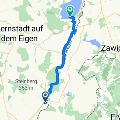
Oder-Neiße-Radweg (Route D 12) 585 Km
A cycling route starting in Bogatynia, Lower Silesian Voivodeship, Poland.
Overview
About this route
Oder-Neisse Cycle Path – enjoy without borders
One path, two rivers, three countries... From the source of the Neisse in the Czech Republic's Nová Ves to Ahlbeck on Usedom, there are 630 exciting kilometers from the Giant Mountains along the German-Polish border to the Baltic Sea. Or from Mescherin continue along the Oder to the metropolis of Szczecin. Where Europe was once divided, the crossings today are fluid. Wide landscapes, old towns, and historic villages are waiting to be discovered. Birds of prey circle in the sky, and the wet meadows of the Oder lowlands are a paradise for storks. Large parts of the landscape are protected, allowing flora and fauna to develop almost undisturbed for many decades. Handcrafted goat cheese, along with a glass of wine from the region, freshly caught fish, a fortifying drink from the monastery brewery, noodles or salami from the living grass mower – the Oder-Neisse Cycle Path offers much not only in scenic and cultural terms, but also culinary delights. So the best conditions for a limitless enjoyment tour.
- -:--
- Duration
- 1,154.8 km
- Distance
- 190 m
- Ascent
- 431 m
- Descent
- ---
- Avg. speed
- ---
- Max. altitude
Continue with Bikemap
Use, edit, or download this cycling route
You would like to ride Oder-Neiße-Radweg (Route D 12) 585 Km or customize it for your own trip? Here is what you can do with this Bikemap route:
Free features
- Save this route as favorite or in collections
- Copy & plan your own version of this route
- Split it into stages to create a multi-day tour
- Sync your route with Garmin or Wahoo
Premium features
Free trial for 3 days, or one-time payment. More about Bikemap Premium.
- Navigate this route on iOS & Android
- Export a GPX / KML file of this route
- Create your custom printout (try it for free)
- Download this route for offline navigation
Discover more Premium features.
Get Bikemap PremiumFrom our community
Other popular routes starting in Bogatynia
 Ruiny zamku w Trzcincu - punkt widokowy na kopalnię - Sieniawka - Bogatynia
- Distance
- 31.5 km
- Ascent
- 266 m
- Descent
- 264 m
- Location
- Bogatynia, Lower Silesian Voivodeship, Poland
 2014-07-03 Zittau-Jeschken-Isergebirge
- Distance
- 109.2 km
- Ascent
- 1,688 m
- Descent
- 1,691 m
- Location
- Bogatynia, Lower Silesian Voivodeship, Poland
 Zittau-Oybin-Görlitz.gpx
- Distance
- 70.5 km
- Ascent
- 470 m
- Descent
- 502 m
- Location
- Bogatynia, Lower Silesian Voivodeship, Poland
 kristýna-osee2
- Distance
- 7.9 km
- Ascent
- 15 m
- Descent
- 16 m
- Location
- Bogatynia, Lower Silesian Voivodeship, Poland
 Oder-Neiße-Radweg (Route D 12) 585 Km
- Distance
- 1,154.8 km
- Ascent
- 190 m
- Descent
- 431 m
- Location
- Bogatynia, Lower Silesian Voivodeship, Poland
 Neisse/Nysa/Nisa: Hirschfelde (Zittau) - Berzdorfer See
- Distance
- 19.5 km
- Ascent
- 128 m
- Descent
- 163 m
- Location
- Bogatynia, Lower Silesian Voivodeship, Poland
 Hrebinek - Rozjazd Chrastava, Bedrichov, Jizera
- Distance
- 24.4 km
- Ascent
- 662 m
- Descent
- 79 m
- Location
- Bogatynia, Lower Silesian Voivodeship, Poland
 wycieczka Smedava
- Distance
- 75.9 km
- Ascent
- 1,035 m
- Descent
- 1,040 m
- Location
- Bogatynia, Lower Silesian Voivodeship, Poland
Open it in the app