1. Mai 2008 Fußweg (optimal mit dem Rad)
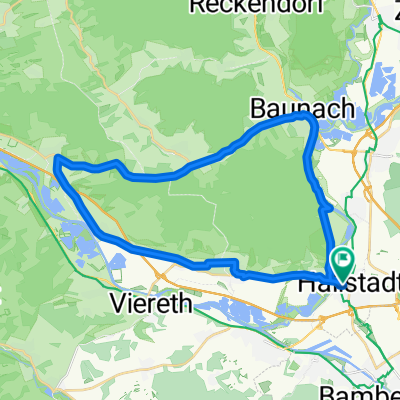
A cycling route starting in Hallstadt, Bavaria, Germany.
Overview
About this route
At the beginning, it is slightly hilly, up to halfway. After that, it is almost all downhill and later nice and flat along the canal.
You don't necessarily have to ride through Bamebrg, but that was our original cart tour.
This route is really a lot of fun, as you are hardly on car-driven roads. Just give it a try.
The unpaved part of the path through the forest is not very long. The path there is similar to a wide track, but it doesn't go more than "gravel". At one point, you have to go through a "stream". This is only about 2-3m wide and a maximum of 20cm deep. You can pass through very slowly.
I ride the route in just under 1.5 hours. In 2 hours, you can do it relatively comfortably.
- -:--
- Duration
- 37.6 km
- Distance
- 209 m
- Ascent
- 209 m
- Descent
- ---
- Avg. speed
- 340 m
- Max. altitude
Route quality
Waytypes & surfaces along the route
Waytypes
Track
12.4 km
(33 %)
Path
8.3 km
(22 %)
Surfaces
Paved
28.6 km
(76 %)
Unpaved
7.5 km
(20 %)
Asphalt
28.6 km
(76 %)
Gravel
5.6 km
(15 %)
Route highlights
Points of interest along the route
Point of interest after 0.9 km
neuer Kreisel für Bahnunterführung
Point of interest after 3.9 km
kurzer Trampelpfad
Point of interest after 7.1 km
Schloß Seehof
Point of interest after 14.2 km
Mini-Bach, kein Problem mit dem Rad
Point of interest after 17.1 km
recht schöne Aussicht
Point of interest after 18.2 km
Griess-Keller bei Geisfeld, sehr gutes Essen (Kellerplatte) und schönes Ambiente
Point of interest after 31.6 km
FT City Beach: Bier, Cocktails, Strand uvm., täglich ab 11:00
Continue with Bikemap
Use, edit, or download this cycling route
You would like to ride 1. Mai 2008 Fußweg (optimal mit dem Rad) or customize it for your own trip? Here is what you can do with this Bikemap route:
Free features
- Save this route as favorite or in collections
- Copy & plan your own version of this route
- Sync your route with Garmin or Wahoo
Premium features
Free trial for 3 days, or one-time payment. More about Bikemap Premium.
- Navigate this route on iOS & Android
- Export a GPX / KML file of this route
- Create your custom printout (try it for free)
- Download this route for offline navigation
Discover more Premium features.
Get Bikemap PremiumFrom our community
Other popular routes starting in Hallstadt
- Stefans Wahl
- Distance
- 28.8 km
- Ascent
- 137 m
- Descent
- 122 m
- Location
- Hallstadt, Bavaria, Germany
- Bamberg Homerun
- Distance
- 21 km
- Ascent
- 305 m
- Descent
- 295 m
- Location
- Hallstadt, Bavaria, Germany
- 1. Mai 2008 Fußweg (optimal mit dem Rad)
- Distance
- 37.6 km
- Ascent
- 209 m
- Descent
- 209 m
- Location
- Hallstadt, Bavaria, Germany
- hügelige Rundfahrt
- Distance
- 62.7 km
- Ascent
- 601 m
- Descent
- 604 m
- Location
- Hallstadt, Bavaria, Germany
- Tour Nr. 3
- Distance
- 39.1 km
- Ascent
- 107 m
- Descent
- 110 m
- Location
- Hallstadt, Bavaria, Germany
- Main / Hallstadt-Schweinfurt
- Distance
- 59.9 km
- Ascent
- 51 m
- Descent
- 85 m
- Location
- Hallstadt, Bavaria, Germany
- M&M Mönchsweiher
- Distance
- 19.7 km
- Ascent
- 511 m
- Descent
- 506 m
- Location
- Hallstadt, Bavaria, Germany
- Bamberg - Würzburg 15.08.-19.08.2017
- Distance
- 152.5 km
- Ascent
- 117 m
- Descent
- 182 m
- Location
- Hallstadt, Bavaria, Germany
Open it in the app