

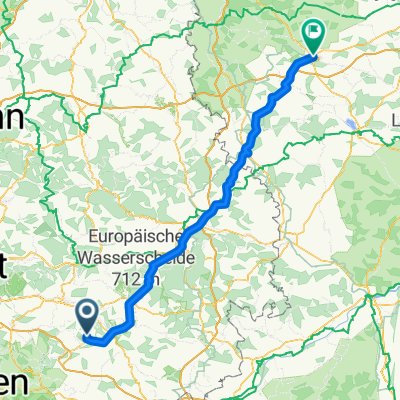
Reichenbach nach Ansbach
A cycling route starting in Deggingen, Baden-Wurttemberg, Germany.
Overview
About this route
Return from Reichenbach to Ansbach and from there back to FO in the VGN area.
- -:--
- Duration
- 126.7 km
- Distance
- 725 m
- Ascent
- 808 m
- Descent
- ---
- Avg. speed
- ---
- Max. altitude

Route quality
Waytypes & surfaces along the route
Waytypes
Quiet road
46.9 km
(37 %)
Road
25.3 km
(20 %)
Surfaces
Paved
86.2 km
(68 %)
Unpaved
3.8 km
(3 %)
Asphalt
71 km
(56 %)
Paved (undefined)
15.2 km
(12 %)
Continue with Bikemap
Use, edit, or download this cycling route
You would like to ride Reichenbach nach Ansbach or customize it for your own trip? Here is what you can do with this Bikemap route:
Free features
- Save this route as favorite or in collections
- Copy & plan your own version of this route
- Split it into stages to create a multi-day tour
- Sync your route with Garmin or Wahoo
Premium features
Free trial for 3 days, or one-time payment. More about Bikemap Premium.
- Navigate this route on iOS & Android
- Export a GPX / KML file of this route
- Create your custom printout (try it for free)
- Download this route for offline navigation
Discover more Premium features.
Get Bikemap PremiumFrom our community
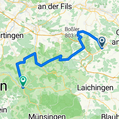
Other popular routes starting in Deggingen
 Reichenbach nach Ansbach
- Distance
- 126.7 km
- Ascent
- 725 m
- Descent
- 808 m
- Location
- Deggingen, Baden-Wurttemberg, Germany
 zügigen rund
- Distance
- 31.2 km
- Ascent
- 885 m
- Descent
- 866 m
- Location
- Deggingen, Baden-Wurttemberg, Germany
 Deggingen - Flugplatz Nortel
- Distance
- 13.3 km
- Ascent
- 231 m
- Descent
- 96 m
- Location
- Deggingen, Baden-Wurttemberg, Germany
 Hausroute 05
- Distance
- 88.3 km
- Ascent
- 1,356 m
- Descent
- 1,356 m
- Location
- Deggingen, Baden-Wurttemberg, Germany
 rund um deggingen
- Distance
- 32.7 km
- Ascent
- 683 m
- Descent
- 650 m
- Location
- Deggingen, Baden-Wurttemberg, Germany
 tdl
tdl- Distance
- 48.9 km
- Ascent
- 1,879 m
- Descent
- 1,905 m
- Location
- Deggingen, Baden-Wurttemberg, Germany
 Klein aber fein mit tollem Ausblick
- Distance
- 17.6 km
- Ascent
- 570 m
- Descent
- 570 m
- Location
- Deggingen, Baden-Wurttemberg, Germany
 Hausrunde
- Distance
- 51.4 km
- Ascent
- 552 m
- Descent
- 552 m
- Location
- Deggingen, Baden-Wurttemberg, Germany
Open it in the app