

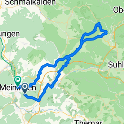
Werra 2009
A cycling route starting in Meiningen, Thuringia, Germany.
Overview
About this route
The Werra Valley cycle path is hard to beat in terms of scenic variety: lush natural romance, healthy forests, flowery meadows, abundant culture – cycling here is a joy.
- -:--
- Duration
- 228.4 km
- Distance
- 982 m
- Ascent
- 1,118 m
- Descent
- ---
- Avg. speed
- 337 m
- Max. altitude
Route quality
Waytypes & surfaces along the route
Waytypes
Track
61.7 km
(27 %)
Quiet road
50.3 km
(22 %)
Surfaces
Paved
166.8 km
(73 %)
Unpaved
32 km
(14 %)
Asphalt
155.3 km
(68 %)
Gravel
20.6 km
(9 %)
Route highlights
Points of interest along the route
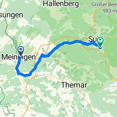
Point of interest after 64.1 km
Continue with Bikemap
Use, edit, or download this cycling route
You would like to ride Werra 2009 or customize it for your own trip? Here is what you can do with this Bikemap route:
Free features
- Save this route as favorite or in collections
- Copy & plan your own version of this route
- Split it into stages to create a multi-day tour
- Sync your route with Garmin or Wahoo
Premium features
Free trial for 3 days, or one-time payment. More about Bikemap Premium.
- Navigate this route on iOS & Android
- Export a GPX / KML file of this route
- Create your custom printout (try it for free)
- Download this route for offline navigation
Discover more Premium features.
Get Bikemap PremiumFrom our community
Other popular routes starting in Meiningen
 MGN-Hohe Mass-Helehenhöe-MGN
- Distance
- 15.7 km
- Ascent
- 274 m
- Descent
- 275 m
- Location
- Meiningen, Thuringia, Germany
 Meiningen nach Ernestinerstraße, Meiningen
- Distance
- 60 km
- Ascent
- 1,084 m
- Descent
- 1,278 m
- Location
- Meiningen, Thuringia, Germany
 Meiningen-Kühndorf-Metzels-Oberwallbachmühle-MGN
- Distance
- 30.3 km
- Ascent
- 409 m
- Descent
- 432 m
- Location
- Meiningen, Thuringia, Germany
 Werra 2009
- Distance
- 228.4 km
- Ascent
- 982 m
- Descent
- 1,118 m
- Location
- Meiningen, Thuringia, Germany
 Gruenes Band 23
- Distance
- 238.3 km
- Ascent
- 2,989 m
- Descent
- 2,799 m
- Location
- Meiningen, Thuringia, Germany
 An den Röthen, Meiningen nach Neuer Friedberg, Suhl
- Distance
- 35 km
- Ascent
- 391 m
- Descent
- 152 m
- Location
- Meiningen, Thuringia, Germany
 Ernestinerstraße, Meiningen nach Ernestinerstraße, Meiningen
- Distance
- 57.6 km
- Ascent
- 1,362 m
- Descent
- 1,362 m
- Location
- Meiningen, Thuringia, Germany
 Am Wandervogel 37, Meiningen nach Am Wandervogel 37, Meiningen
- Distance
- 31.4 km
- Ascent
- 491 m
- Descent
- 491 m
- Location
- Meiningen, Thuringia, Germany
Open it in the app