

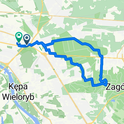
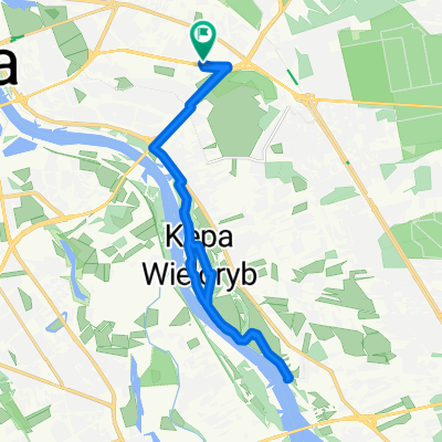
Wał Miedzeszyński - Bysławska 11
A cycling route starting in Praga Południe, Masovian Voivodeship, Poland.
Overview
About this route
- 1 h 39 min
- Duration
- 13.8 km
- Distance
- 26 m
- Ascent
- 18 m
- Descent
- 8.4 km/h
- Avg. speed
- ---
- Max. altitude

Route highlights
Points of interest along the route

Point of interest after 0.3 km
Wisła
Point of interest after 3 km
Point of interest after 3 km

Point of interest after 3 km

Point of interest after 5.5 km

Point of interest after 6.3 km

Point of interest after 8.2 km
Point of interest after 9.5 km
Point of interest after 9.6 km
Point of interest after 11.3 km
Continue with Bikemap
Use, edit, or download this cycling route
You would like to ride Wał Miedzeszyński - Bysławska 11 or customize it for your own trip? Here is what you can do with this Bikemap route:
Free features
- Save this route as favorite or in collections
- Copy & plan your own version of this route
- Sync your route with Garmin or Wahoo
Premium features
Free trial for 3 days, or one-time payment. More about Bikemap Premium.
- Navigate this route on iOS & Android
- Export a GPX / KML file of this route
- Create your custom printout (try it for free)
- Download this route for offline navigation
Discover more Premium features.
Get Bikemap PremiumFrom our community
Other popular routes starting in Praga Południe
 Prochowa 49, Warszawa do Kobielska 60, Warszawa
- Distance
- 36.9 km
- Ascent
- 150 m
- Descent
- 146 m
- Location
- Praga Południe, Masovian Voivodeship, Poland
 nowa trasa 26.08
- Distance
- 18.8 km
- Ascent
- 55 m
- Descent
- 55 m
- Location
- Praga Południe, Masovian Voivodeship, Poland
 Trening szosówką.
- Distance
- 56.2 km
- Ascent
- 34 m
- Descent
- 34 m
- Location
- Praga Południe, Masovian Voivodeship, Poland
 Szarlotka w Dakowie
- Distance
- 26.4 km
- Ascent
- 65 m
- Descent
- 64 m
- Location
- Praga Południe, Masovian Voivodeship, Poland
 nieporet
- Distance
- 97.4 km
- Ascent
- 64 m
- Descent
- 67 m
- Location
- Praga Południe, Masovian Voivodeship, Poland
 Wał Miedzeszyński - Bysławska 11
- Distance
- 13.8 km
- Ascent
- 26 m
- Descent
- 18 m
- Location
- Praga Południe, Masovian Voivodeship, Poland
 O_Wzdłuż Wisły Choszczówka Bródno Wschodnia
- Distance
- 46.5 km
- Ascent
- 24 m
- Descent
- 25 m
- Location
- Praga Południe, Masovian Voivodeship, Poland
 Ognisko nad Wisłą
- Distance
- 20.4 km
- Ascent
- 23 m
- Descent
- 24 m
- Location
- Praga Południe, Masovian Voivodeship, Poland
Open it in the app