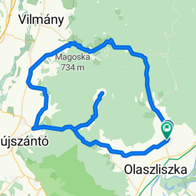
Kékednek
A cycling route starting in Tolcsva, Borsod-Abauj Zemplen county, Hungary.
Overview
About this route
Sárazsadány Erdőbénye Boldogkőváralja Gönc Kéked Hollóháza Filkeháza Pálháza Sátoraljaújhely Sárospatak Sárazsadány
- -:--
- Duration
- 125 km
- Distance
- 701 m
- Ascent
- 701 m
- Descent
- ---
- Avg. speed
- ---
- Avg. speed
Route quality
Waytypes & surfaces along the route
Waytypes
Busy road
78.7 km
(63 %)
Cycleway
15.2 km
(12 %)
Surfaces
Paved
26.4 km
(21 %)
Unpaved
6.4 km
(5 %)
Asphalt
24.7 km
(20 %)
Gravel
4.8 km
(4 %)
Continue with Bikemap
Use, edit, or download this cycling route
You would like to ride Kékednek or customize it for your own trip? Here is what you can do with this Bikemap route:
Free features
- Save this route as favorite or in collections
- Copy & plan your own version of this route
- Sync your route with Garmin or Wahoo
Premium features
Free trial for 3 days, or one-time payment. More about Bikemap Premium.
- Navigate this route on iOS & Android
- Export a GPX / KML file of this route
- Create your custom printout (try it for free)
- Download this route for offline navigation
Discover more Premium features.
Get Bikemap PremiumFrom our community
Other popular routes starting in Tolcsva
- Zemplén 3. nap
- Distance
- 61.5 km
- Ascent
- 540 m
- Descent
- 540 m
- Location
- Tolcsva, Borsod-Abauj Zemplen county, Hungary
- Zemplén karika
- Distance
- 63.6 km
- Ascent
- 516 m
- Descent
- 513 m
- Location
- Tolcsva, Borsod-Abauj Zemplen county, Hungary
- TOLCSVA Kör
- Distance
- 61.2 km
- Ascent
- 863 m
- Descent
- 860 m
- Location
- Tolcsva, Borsod-Abauj Zemplen county, Hungary
- zemplén karika
- Distance
- 117.1 km
- Ascent
- 1,636 m
- Descent
- 1,636 m
- Location
- Tolcsva, Borsod-Abauj Zemplen county, Hungary
- Kossuth út 22, Háromhuta to Petőfi út 3, Háromhuta
- Distance
- 22.6 km
- Ascent
- 820 m
- Descent
- 869 m
- Location
- Tolcsva, Borsod-Abauj Zemplen county, Hungary
- É-M.o/3
- Distance
- 96.7 km
- Ascent
- 107 m
- Descent
- 217 m
- Location
- Tolcsva, Borsod-Abauj Zemplen county, Hungary
- Zempléni túra 2 nap
- Distance
- 85.2 km
- Ascent
- 547 m
- Descent
- 545 m
- Location
- Tolcsva, Borsod-Abauj Zemplen county, Hungary
- Kékednek
- Distance
- 125 km
- Ascent
- 701 m
- Descent
- 701 m
- Location
- Tolcsva, Borsod-Abauj Zemplen county, Hungary