
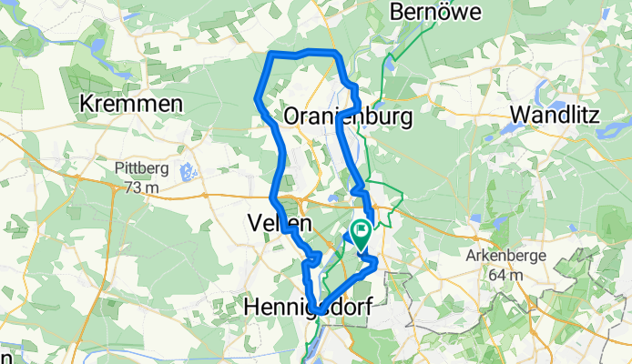
HN-Hennigsdorf-Germendorf-Oranienburg-HN
A cycling route starting in Hohen Neuendorf, Brandenburg, Germany.
Overview
About this route
Trip to the district town,
partially with many cars on the road
- -:--
- Duration
- 51.1 km
- Distance
- 103 m
- Ascent
- 105 m
- Descent
- ---
- Avg. speed
- 58 m
- Max. altitude

Route quality
Waytypes & surfaces along the route
Waytypes
Quiet road
13.3 km
(26 %)
Road
8.7 km
(17 %)
Surfaces
Paved
42.4 km
(83 %)
Unpaved
1.5 km
(3 %)
Asphalt
42.4 km
(83 %)
Ground
1 km
(2 %)
Continue with Bikemap
Use, edit, or download this cycling route
You would like to ride HN-Hennigsdorf-Germendorf-Oranienburg-HN or customize it for your own trip? Here is what you can do with this Bikemap route:
Free features
- Save this route as favorite or in collections
- Copy & plan your own version of this route
- Sync your route with Garmin or Wahoo
Premium features
Free trial for 3 days, or one-time payment. More about Bikemap Premium.
- Navigate this route on iOS & Android
- Export a GPX / KML file of this route
- Create your custom printout (try it for free)
- Download this route for offline navigation
Discover more Premium features.
Get Bikemap PremiumFrom our community
Other popular routes starting in Hohen Neuendorf
 Bergfelde, Hohen Neuendorf nach Talsandweg, Berlin
- Distance
- 9.8 km
- Ascent
- 47 m
- Descent
- 54 m
- Location
- Hohen Neuendorf, Brandenburg, Germany
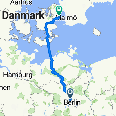
 17 Berlin-Warendorf
- Distance
- 546.8 km
- Ascent
- 203 m
- Descent
- 205 m
- Location
- Hohen Neuendorf, Brandenburg, Germany
 Feierabendrunde Hohen Neuendorf - Tegler Fließ - Hohen Neuendorf
- Distance
- 25.3 km
- Ascent
- 90 m
- Descent
- 92 m
- Location
- Hohen Neuendorf, Brandenburg, Germany
 Unbenannte Route
- Distance
- 504.1 km
- Ascent
- 1,753 m
- Descent
- 1,800 m
- Location
- Hohen Neuendorf, Brandenburg, Germany
 Rad Hennigsdorf_Niederheide
- Distance
- 16.5 km
- Ascent
- 46 m
- Descent
- 45 m
- Location
- Hohen Neuendorf, Brandenburg, Germany
 HoNeu-Wensickendorf-Zehlendorf-Friedrichsthal-Lehnitzsee-Borgsdorf-HoNeu
- Distance
- 47.3 km
- Ascent
- 97 m
- Descent
- 97 m
- Location
- Hohen Neuendorf, Brandenburg, Germany
 240km_HND_Schorfh_Uckermark_HND
- Distance
- 241 km
- Ascent
- 228 m
- Descent
- 228 m
- Location
- Hohen Neuendorf, Brandenburg, Germany
 Jacob-Wins-Straße 17, Hohen Neuendorf nach Jacob-Wins-Straße 17, Hohen Neuendorf
- Distance
- 19.3 km
- Ascent
- 103 m
- Descent
- 108 m
- Location
- Hohen Neuendorf, Brandenburg, Germany
Open it in the app