

Alling, Hohe Wand
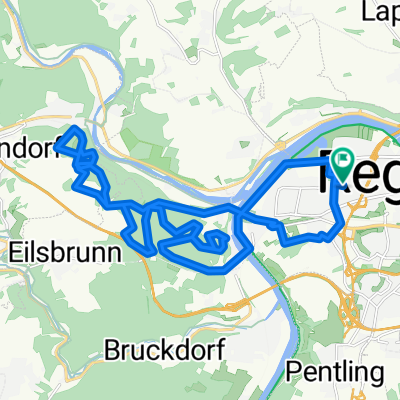
A cycling route starting in Sinzing, Bavaria, Germany.
Overview
About this route
Gemütliche Tour Richtung Alling mit hoher Wand.
- -:--
- Duration
- 17.2 km
- Distance
- 346 m
- Ascent
- 352 m
- Descent
- ---
- Avg. speed
- ---
- Max. altitude

Continue with Bikemap
Use, edit, or download this cycling route
You would like to ride Alling, Hohe Wand or customize it for your own trip? Here is what you can do with this Bikemap route:
Free features
- Save this route as favorite or in collections
- Copy & plan your own version of this route
- Sync your route with Garmin or Wahoo
Premium features
Free trial for 3 days, or one-time payment. More about Bikemap Premium.
- Navigate this route on iOS & Android
- Export a GPX / KML file of this route
- Create your custom printout (try it for free)
- Download this route for offline navigation
Discover more Premium features.
Get Bikemap PremiumFrom our community
Other popular routes starting in Sinzing
 Ultimate Trail Regensburg
- Distance
- 27.7 km
- Ascent
- 550 m
- Descent
- 550 m
- Location
- Sinzing, Bavaria, Germany
 Regensburg
- Distance
- 17.1 km
- Ascent
- 168 m
- Descent
- 169 m
- Location
- Sinzing, Bavaria, Germany
 Alling, Hohe Wand
- Distance
- 17.2 km
- Ascent
- 346 m
- Descent
- 352 m
- Location
- Sinzing, Bavaria, Germany
 R-Donau-Laaber-Naab-R
- Distance
- 78.2 km
- Ascent
- 1,025 m
- Descent
- 1,025 m
- Location
- Sinzing, Bavaria, Germany
 Schlossgarten bis Etterzhausen, viele Trails
- Distance
- 15.7 km
- Ascent
- 358 m
- Descent
- 358 m
- Location
- Sinzing, Bavaria, Germany
 Tour zur großen Bärenhöhle
- Distance
- 17.9 km
- Ascent
- 424 m
- Descent
- 427 m
- Location
- Sinzing, Bavaria, Germany
 Rundfahrt Regensburg-Riedenburg
- Distance
- 77.6 km
- Ascent
- 782 m
- Descent
- 777 m
- Location
- Sinzing, Bavaria, Germany
 Pettendorf - Kallmünz
- Distance
- 28.5 km
- Ascent
- 991 m
- Descent
- 983 m
- Location
- Sinzing, Bavaria, Germany
Open it in the app