

Leutschach - Bad Radkersburg 2
A cycling route starting in Leutschach, Styria, Austria.
Overview
About this route
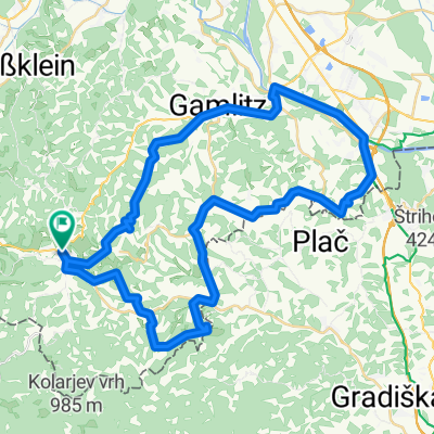
Leutschach - Bad Radkersburg über R 54 und R 2
- -:--
- Duration
- 69.8 km
- Distance
- 480 m
- Ascent
- 620 m
- Descent
- ---
- Avg. speed
- ---
- Avg. speed

Route quality
Waytypes & surfaces along the route
Waytypes
Quiet road
40.8 km
(58 %)
Track
7.3 km
(11 %)
Surfaces
Paved
34.6 km
(50 %)
Unpaved
9.1 km
(13 %)
Asphalt
34.4 km
(49 %)
Gravel
7.4 km
(11 %)
Continue with Bikemap
Use, edit, or download this cycling route
You would like to ride Leutschach - Bad Radkersburg 2 or customize it for your own trip? Here is what you can do with this Bikemap route:
Free features
- Save this route as favorite or in collections
- Copy & plan your own version of this route
- Sync your route with Garmin or Wahoo
Premium features
Free trial for 3 days, or one-time payment. More about Bikemap Premium.
- Navigate this route on iOS & Android
- Export a GPX / KML file of this route
- Create your custom printout (try it for free)
- Download this route for offline navigation
Discover more Premium features.
Get Bikemap PremiumFrom our community
Other popular routes starting in Leutschach
 Leutschach-Seggautal
- Distance
- 39.7 km
- Ascent
- 892 m
- Descent
- 892 m
- Location
- Leutschach, Styria, Austria
 Weinstraßenausfahrt - Kreuzberg-Saggautal-Remschnigg - Weinstraßenausfahrt - Kreuzberg-Saggautal-Remschnigg
- Distance
- 41.2 km
- Ascent
- 1,084 m
- Descent
- 1,087 m
- Location
- Leutschach, Styria, Austria
 Austria Dzien 9 Leutschach - Neubdauberg
- Distance
- 105.6 km
- Ascent
- 458 m
- Descent
- 454 m
- Location
- Leutschach, Styria, Austria
 Weinstraßen-Panoramaweg
- Distance
- 49.5 km
- Ascent
- 1,021 m
- Descent
- 1,021 m
- Location
- Leutschach, Styria, Austria
 Vogljager Nordausfahrt
- Distance
- 35.6 km
- Ascent
- 1,163 m
- Descent
- 1,158 m
- Location
- Leutschach, Styria, Austria
 Remschnigg
- Distance
- 18.2 km
- Ascent
- 466 m
- Descent
- 464 m
- Location
- Leutschach, Styria, Austria
 Leutschach - Weinstraße - Route 1
- Distance
- 35.5 km
- Ascent
- 681 m
- Descent
- 684 m
- Location
- Leutschach, Styria, Austria
 Weinstraßenausfahrt - Panoramaradweg-Südsteirische Weinstraße
- Distance
- 49.3 km
- Ascent
- 1,103 m
- Descent
- 1,103 m
- Location
- Leutschach, Styria, Austria
Open it in the app