

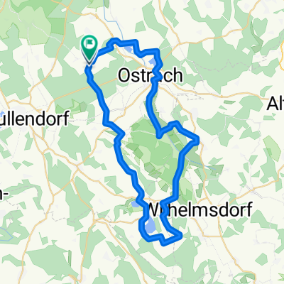
Ostrach - Geltendorf
A cycling route starting in Ostrach, Baden-Württemberg, Germany.
Overview
About this route
Standardroute mit Optimierung für die Bahnbrückenbaustelle in Aulendorf. Nicht berücksichtigt ist die eventuelle Baustelle zwischen Niederrieden und Holzgünz.
(cloned from route 3235308)- -:--
- Duration
- 150.4 km
- Distance
- 529 m
- Ascent
- 580 m
- Descent
- ---
- Avg. speed
- ---
- Max. altitude
Route quality
Waytypes & surfaces along the route
Waytypes
Road
59.2 km
(39 %)
Busy road
38.6 km
(26 %)
Surfaces
Paved
88.8 km
(59 %)
Unpaved
5 km
(3 %)
Asphalt
86.8 km
(58 %)
Gravel
2.3 km
(2 %)
Continue with Bikemap
Use, edit, or download this cycling route
You would like to ride Ostrach - Geltendorf or customize it for your own trip? Here is what you can do with this Bikemap route:
Free features
- Save this route as favorite or in collections
- Copy & plan your own version of this route
- Split it into stages to create a multi-day tour
- Sync your route with Garmin or Wahoo
Premium features
Free trial for 3 days, or one-time payment. More about Bikemap Premium.
- Navigate this route on iOS & Android
- Export a GPX / KML file of this route
- Create your custom printout (try it for free)
- Download this route for offline navigation
Discover more Premium features.
Get Bikemap PremiumFrom our community
Other popular routes starting in Ostrach
 Über den Höchsten und den Judentenberg
- Distance
- 56.5 km
- Ascent
- 607 m
- Descent
- 610 m
- Location
- Ostrach, Baden-Württemberg, Germany
 Pfrungener Ried
- Distance
- 28.3 km
- Ascent
- 156 m
- Descent
- 162 m
- Location
- Ostrach, Baden-Württemberg, Germany
 Rundtour Levertsweiler-Sigmaringen u. zurück
- Distance
- 50.4 km
- Ascent
- 215 m
- Descent
- 210 m
- Location
- Ostrach, Baden-Württemberg, Germany
 Ostrach - Geltendorf
- Distance
- 150.4 km
- Ascent
- 529 m
- Descent
- 580 m
- Location
- Ostrach, Baden-Württemberg, Germany
 Fb-Erba-2
- Distance
- 153.2 km
- Ascent
- 942 m
- Descent
- 1,057 m
- Location
- Ostrach, Baden-Württemberg, Germany
 Ostrach-Donautal-Ablachtal-Ostrach
- Distance
- 70 km
- Ascent
- 798 m
- Descent
- 787 m
- Location
- Ostrach, Baden-Württemberg, Germany
 Ostrach - Ornbau - ruhige VM-Strecke
- Distance
- 224.1 km
- Ascent
- 391 m
- Descent
- 581 m
- Location
- Ostrach, Baden-Württemberg, Germany
 Illmensee
- Distance
- 46.5 km
- Ascent
- 563 m
- Descent
- 564 m
- Location
- Ostrach, Baden-Württemberg, Germany
Open it in the app