
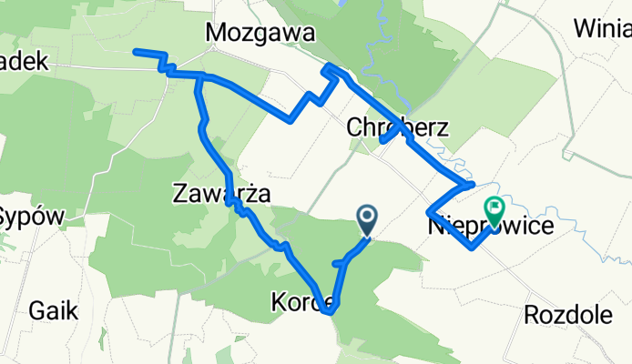
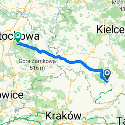
Kozubów, Wojsławice, Wola Chroberska, Nieprowice
A cycling route starting in Gmina Złota, Świętokrzyskie Voivodship, Poland.
Overview
About this route
Kozubów, Wojsławice, Wola Chroberska, Nieprowice
Przed Zawalą przez pole, bez drogi- 4 h 22 min
- Duration
- 29 km
- Distance
- 183 m
- Ascent
- 242 m
- Descent
- 6.6 km/h
- Avg. speed
- ---
- Max. altitude
Continue with Bikemap
Use, edit, or download this cycling route
You would like to ride Kozubów, Wojsławice, Wola Chroberska, Nieprowice or customize it for your own trip? Here is what you can do with this Bikemap route:
Free features
- Save this route as favorite or in collections
- Copy & plan your own version of this route
- Sync your route with Garmin or Wahoo
Premium features
Free trial for 3 days, or one-time payment. More about Bikemap Premium.
- Navigate this route on iOS & Android
- Export a GPX / KML file of this route
- Create your custom printout (try it for free)
- Download this route for offline navigation
Discover more Premium features.
Get Bikemap PremiumFrom our community
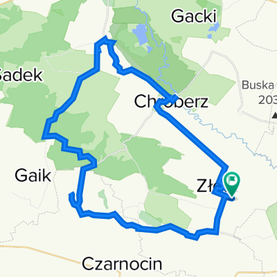
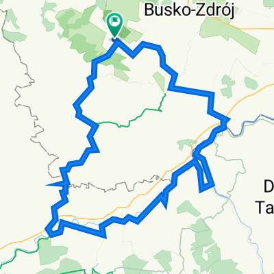
Other popular routes starting in Gmina Złota
 złota wieś
- Distance
- 45.1 km
- Ascent
- 414 m
- Descent
- 415 m
- Location
- Gmina Złota, Świętokrzyskie Voivodship, Poland
 Winiary- Książ Wielki
- Distance
- 57.7 km
- Ascent
- 277 m
- Descent
- 241 m
- Location
- Gmina Złota, Świętokrzyskie Voivodship, Poland
 H Sienkiewicza, Złota do H Sienkiewicza, Złota
- Distance
- 11.3 km
- Ascent
- 68 m
- Descent
- 70 m
- Location
- Gmina Złota, Świętokrzyskie Voivodship, Poland
 Plan rekordu dlugosci trasy, wiślana trasa rowerowa
- Distance
- 151 km
- Ascent
- 571 m
- Descent
- 571 m
- Location
- Gmina Złota, Świętokrzyskie Voivodship, Poland
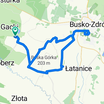 Gacki-Busko Zdrój-Gacki
- Distance
- 35.3 km
- Ascent
- 149 m
- Descent
- 149 m
- Location
- Gmina Złota, Świętokrzyskie Voivodship, Poland
 Ponidzie rowerowo
- Distance
- 37.1 km
- Ascent
- 322 m
- Descent
- 318 m
- Location
- Gmina Złota, Świętokrzyskie Voivodship, Poland
 złota
złota- Distance
- 68.6 km
- Ascent
- 685 m
- Descent
- 702 m
- Location
- Gmina Złota, Świętokrzyskie Voivodship, Poland
 etap_II
- Distance
- 117.2 km
- Ascent
- 261 m
- Descent
- 150 m
- Location
- Gmina Złota, Świętokrzyskie Voivodship, Poland
Open it in the app