

Kreidacher Höhe - Tromm
A cycling route starting in Rimbach, Hesse, Germany.
Overview
About this route
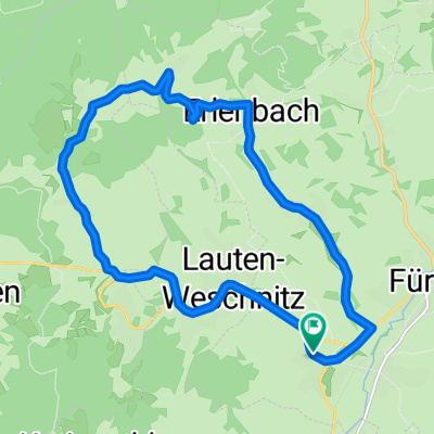
Zwischen Kocherbach und Weschnitz ist immer wenig Verkehr :-)
In Richtung Tromm geht es richitg steil hinauf. Schätze, dass es 10% sind.- -:--
- Duration
- 41 km
- Distance
- 585 m
- Ascent
- 585 m
- Descent
- ---
- Avg. speed
- ---
- Max. altitude

Route quality
Waytypes & surfaces along the route
Waytypes
Busy road
16.7 km
(41 %)
Quiet road
9.8 km
(24 %)
Surfaces
Paved
34.9 km
(85 %)
Unpaved
2.4 km
(6 %)
Asphalt
33 km
(81 %)
Gravel
2 km
(5 %)
Continue with Bikemap
Use, edit, or download this cycling route
You would like to ride Kreidacher Höhe - Tromm or customize it for your own trip? Here is what you can do with this Bikemap route:
Free features
- Save this route as favorite or in collections
- Copy & plan your own version of this route
- Sync your route with Garmin or Wahoo
Premium features
Free trial for 3 days, or one-time payment. More about Bikemap Premium.
- Navigate this route on iOS & Android
- Export a GPX / KML file of this route
- Create your custom printout (try it for free)
- Download this route for offline navigation
Discover more Premium features.
Get Bikemap PremiumFrom our community
Other popular routes starting in Rimbach
 Gersprenz - Brombachtal - Otzberg
- Distance
- 65.9 km
- Ascent
- 532 m
- Descent
- 532 m
- Location
- Rimbach, Hesse, Germany
 Fürth - Winterkasten - Fr.-Crumbach - Ostern
- Distance
- 44.4 km
- Ascent
- 570 m
- Descent
- 570 m
- Location
- Rimbach, Hesse, Germany
 Tromm-Runde
- Distance
- 39.1 km
- Ascent
- 711 m
- Descent
- 711 m
- Location
- Rimbach, Hesse, Germany
 Rundkurs
- Distance
- 13.6 km
- Ascent
- 224 m
- Descent
- 222 m
- Location
- Rimbach, Hesse, Germany
 Überwaldrunde
- Distance
- 49.5 km
- Ascent
- 1,171 m
- Descent
- 1,171 m
- Location
- Rimbach, Hesse, Germany
 Juhöhe - Hüttelfeld - Weinheim - Lampenhain - Siedelsbrunn
- Distance
- 79.6 km
- Ascent
- 778 m
- Descent
- 780 m
- Location
- Rimbach, Hesse, Germany
 Kreidacher Höhe - Tromm
- Distance
- 41 km
- Ascent
- 585 m
- Descent
- 585 m
- Location
- Rimbach, Hesse, Germany
 Seeheim - Neunkirchen
- Distance
- 59.9 km
- Ascent
- 688 m
- Descent
- 688 m
- Location
- Rimbach, Hesse, Germany
Open it in the app