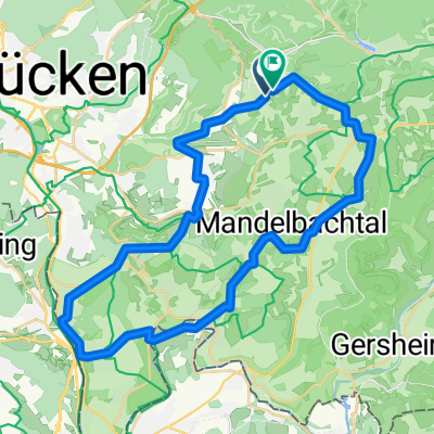
Hüttenwanderweg
- 11.9 km
- 449 m
- 449 m
- Sankt Ingbert, Saarland, Germany
A cycling route starting in Sankt Ingbert, Saarland, Germany.
Overview
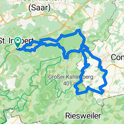
From St. Ingbert (blue parking lot) over Hassel to Kirkel; first up, then down into the Tauben valley; continue to Beeder Brünnchen (fisherman's hut) and on to Schwarzenbach; through the Lambsbach valley over Kirrberg and Bechhofen to Lambsborn; now up to Martinshöhe and down at the exit of the village (gravel!) to Labach; here one should visit the medieval church and the cemetery; continue down through Wallhalben into the Mühlental and - either on the road or on the marked forest path - to the Kneispermühle (refreshment possibility); continue into the Schwarzbach valley and at Thaleischweiler onto the bike path, which you will follow to the Zweibrücken train station.
created this 10 years ago
Route quality
Track
19.2 km
(24 %)
Path
16 km
(20 %)
Paved
62.3 km
(78 %)
Unpaved
11.2 km
(14 %)
Asphalt
45.5 km
(57 %)
Paved (undefined)
16.8 km
(21 %)
Continue with Bikemap
You would like to ride Westpfalz 1 or customize it for your own trip? Here is what you can do with this Bikemap route:
Free trial for 3 days, or one-time payment. More about Bikemap Premium.
Discover more Premium features.
Get Bikemap PremiumFrom our community
Open it in the app