

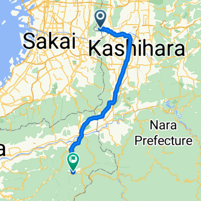
中和幹線〜
A cycling route starting in Kashihara, Osaka, Japan.
Overview
About this route
- 2 h 21 min
- Duration
- 46.2 km
- Distance
- 260 m
- Ascent
- 257 m
- Descent
- 19.7 km/h
- Avg. speed
- ---
- Max. altitude
Route quality
Waytypes & surfaces along the route
Waytypes
Quiet road
10.6 km
(23 %)
Cycleway
10.6 km
(23 %)
Surfaces
Paved
18.9 km
(41 %)
Paved (undefined)
18.5 km
(40 %)
Asphalt
0.5 km
(1 %)
Undefined
27.3 km
(59 %)
Continue with Bikemap
Use, edit, or download this cycling route
You would like to ride 中和幹線〜 or customize it for your own trip? Here is what you can do with this Bikemap route:
Free features
- Save this route as favorite or in collections
- Copy & plan your own version of this route
- Sync your route with Garmin or Wahoo
Premium features
Free trial for 3 days, or one-time payment. More about Bikemap Premium.
- Navigate this route on iOS & Android
- Export a GPX / KML file of this route
- Create your custom printout (try it for free)
- Download this route for offline navigation
Discover more Premium features.
Get Bikemap PremiumFrom our community
Other popular routes starting in Kashihara
 ヴェロスタfastest
- Distance
- 15.9 km
- Ascent
- 39 m
- Descent
- 29 m
- Location
- Kashihara, Osaka, Japan
 河内長野→狭山→堺
- Distance
- 56.5 km
- Ascent
- 449 m
- Descent
- 448 m
- Location
- Kashihara, Osaka, Japan
 ル・カフェ・サリュ加美
- Distance
- 6 km
- Ascent
- 4 m
- Descent
- 6 m
- Location
- Kashihara, Osaka, Japan
 1,柏原〜彼方
- Distance
- 14.5 km
- Ascent
- 80 m
- Descent
- 23 m
- Location
- Kashihara, Osaka, Japan
 道明寺発~水越峠~十三峠 80km
- Distance
- 81.2 km
- Ascent
- 1,689 m
- Descent
- 1,691 m
- Location
- Kashihara, Osaka, Japan
 デザインホテル
- Distance
- 10 km
- Ascent
- 17 m
- Descent
- 25 m
- Location
- Kashihara, Osaka, Japan
 Shigisan to Koyasan
- Distance
- 62.6 km
- Ascent
- 1,238 m
- Descent
- 696 m
- Location
- Kashihara, Osaka, Japan
 ローソン杭全
- Distance
- 9.9 km
- Ascent
- 14 m
- Descent
- 21 m
- Location
- Kashihara, Osaka, Japan
Open it in the app