
Mt Brouilly/Casse Froide 29-08-15
A cycling route starting in Beaujeu, Auvergne-Rhône-Alpes, France.
Overview
About this route
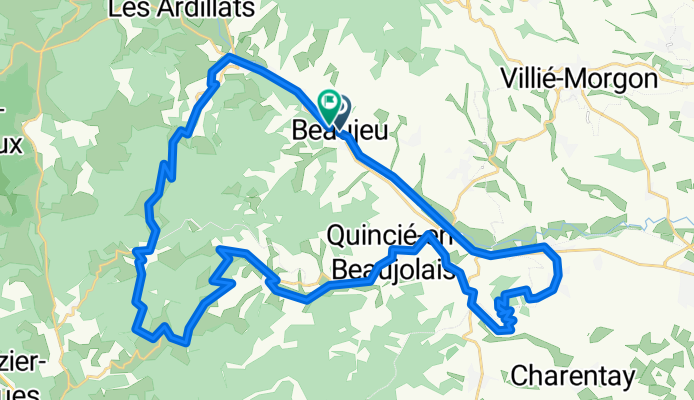
Beaujeu Greenway Saint Lager Start of the climb at the church square, between the 2 restaurants Mont Brouilly (3kms at 8.5%) Descent Col de Casse froide (10kms at 4%; max 18%) Descent Beaujeu
- -:--
- Duration
- 44.1 km
- Distance
- 963 m
- Ascent
- 953 m
- Descent
- ---
- Avg. speed
- ---
- Max. altitude
Route quality
Waytypes & surfaces along the route
Waytypes
Quiet road
11 km
(25 %)
Road
8.4 km
(19 %)
Surfaces
Paved
14.1 km
(32 %)
Asphalt
14.1 km
(32 %)
Undefined
30 km
(68 %)
Continue with Bikemap
Use, edit, or download this cycling route
You would like to ride Mt Brouilly/Casse Froide 29-08-15 or customize it for your own trip? Here is what you can do with this Bikemap route:
Free features
- Save this route as favorite or in collections
- Copy & plan your own version of this route
- Sync your route with Garmin or Wahoo
Premium features
Free trial for 3 days, or one-time payment. More about Bikemap Premium.
- Navigate this route on iOS & Android
- Export a GPX / KML file of this route
- Create your custom printout (try it for free)
- Download this route for offline navigation
Discover more Premium features.
Get Bikemap PremiumFrom our community
Other popular routes starting in Beaujeu
 Vernay à Écoche
- Distance
- 31.1 km
- Ascent
- 861 m
- Descent
- 1,014 m
- Location
- Beaujeu, Auvergne-Rhône-Alpes, France
 Poligny - Mont Saint-Rigaud
- Distance
- 208.5 km
- Ascent
- 1,345 m
- Descent
- 2,067 m
- Location
- Beaujeu, Auvergne-Rhône-Alpes, France
 Beaujolais 3
- Distance
- 87.5 km
- Ascent
- 1,267 m
- Descent
- 1,267 m
- Location
- Beaujeu, Auvergne-Rhône-Alpes, France
 Cols Nord-Est
- Distance
- 1.7 km
- Ascent
- 32 m
- Descent
- 62 m
- Location
- Beaujeu, Auvergne-Rhône-Alpes, France
 Itinéraire facile en Monsols
- Distance
- 18.4 km
- Ascent
- 359 m
- Descent
- 359 m
- Location
- Beaujeu, Auvergne-Rhône-Alpes, France
 Le Perrier, Vernay à 136 Route du Fétre, Chiroubles
- Distance
- 35.8 km
- Ascent
- 1,126 m
- Descent
- 1,202 m
- Location
- Beaujeu, Auvergne-Rhône-Alpes, France
 Bresse-Dombes
- Distance
- 147.1 km
- Ascent
- 425 m
- Descent
- 425 m
- Location
- Beaujeu, Auvergne-Rhône-Alpes, France
 Ouroux Direct to Julienas
- Distance
- 17.2 km
- Ascent
- 315 m
- Descent
- 496 m
- Location
- Beaujeu, Auvergne-Rhône-Alpes, France
Open it in the app