- 39.3 km
- 731 m
- 730 m
- Szklarska Por臋ba, Lower Silesian Voivodeship, Poland
Szklarska Por臋ba - Harrachov
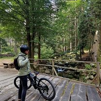
A cycling route starting in Szklarska Por臋ba, Lower Silesian Voivodeship, Poland.
Overview
About this route
Trasa Szklarska Por臋ba - Harahov biegnie drog膮 krajow膮 nr 3 do przej艣cia granicznego w Jakuszycach. Trasa, pomimo i偶 jest to droga krajowa, nie jest nadto zat艂oczona, a mo偶na powiedzie膰, 偶e czasami ruch tam jest nawet niski, cho膰 od czasu do czasu pojawiaj膮 si臋 tam du偶e TIR-y, co mo偶e by膰 pewnym utrudnieniem.
- -:--
- Duration
- 12.2 km
- Distance
- 253 m
- Ascent
- 262 m
- Descent
- ---
- Avg. speed
- ---
- Max. altitude
created this 10 years ago
Route quality
Waytypes & surfaces along the route
Waytypes
Access road
0.5 km
(4 %)
Undefined
11.7 km
(96 %)
Surfaces
Paved
11.7 km
(96 %)
Asphalt
11.7 km
(96 %)
Undefined
0.5 km
(4 %)
Continue with Bikemap
Use, edit, or download this cycling route
You would like to ride Szklarska Por臋ba - Harrachov or customize it for your own trip? Here is what you can do with this Bikemap route:
Free features
- Save this route as favorite or in collections
- Copy & plan your own version of this route
- Sync your route with Garmin or Wahoo
Premium features
Free trial for 3 days, or one-time payment. More about Bikemap Premium.
- Navigate this route on iOS & Android
- Export a GPX / KML file of this route
- Create your custom printout (try it for free)
- Download this route for offline navigation
Discover more Premium features.
Get Bikemap PremiumFrom our community
Other popular routes starting in Szklarska Por臋ba
- Jakuszyce - St贸g Izerski
- Kopalnia Stanis艂aw
- 23.3 km
- 384 m
- 400 m
- Szklarska Por臋ba, Lower Silesian Voivodeship, Poland
- Franciszka艅ska 16A do Plac Zdrojowy
- 23.5 km
- 151 m
- 509 m
- Szklarska Por臋ba, Lower Silesian Voivodeship, Poland
- SZKLARSKA - LIBEREC/Frydlant/艢wierad贸w - Szklarska
- 105.8 km
- 1,493 m
- 1,462 m
- Szklarska Por臋ba, Lower Silesian Voivodeship, Poland
- Recovered Route
- 40.9 km
- 1,136 m
- 1,196 m
- Szklarska Por臋ba, Lower Silesian Voivodeship, Poland
- Szklarska Por臋ba - Zwalisko - Przednia Kopa- Chatka G贸rzyst贸w
- 31.5 km
- 619 m
- 618 m
- Szklarska Por臋ba, Lower Silesian Voivodeship, Poland
- Wok贸艂 Karpat
- 60.3 km
- 1,777 m
- 1,774 m
- Szklarska Por臋ba, Lower Silesian Voivodeship, Poland
- Jedno艣ci Narodowej, Szklarska Por臋ba do W艂adys艂awa Grabskiego, Szklarska Por臋ba
- 35.3 km
- 860 m
- 861 m
- Szklarska Por臋ba, Lower Silesian Voivodeship, Poland
Open it in the app


