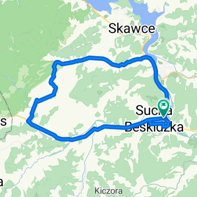
30.08.2015
A cycling route starting in Sucha Beskidzka, Lesser Poland Voivodeship, Poland.
Overview
About this route
time: 5h.40 min.
temp. 35 stopni- -:--
- Duration
- 129.6 km
- Distance
- 1,073 m
- Ascent
- 1,073 m
- Descent
- ---
- Avg. speed
- ---
- Avg. speed
Route quality
Waytypes & surfaces along the route
Waytypes
Road
76.2 km
(59 %)
Quiet road
21.4 km
(17 %)
Surfaces
Paved
115 km
(89 %)
Unpaved
0.4 km
(<1 %)
Asphalt
109.2 km
(84 %)
Paving stones
5.6 km
(4 %)
Continue with Bikemap
Use, edit, or download this cycling route
You would like to ride 30.08.2015 or customize it for your own trip? Here is what you can do with this Bikemap route:
Free features
- Save this route as favorite or in collections
- Copy & plan your own version of this route
- Sync your route with Garmin or Wahoo
Premium features
Free trial for 3 days, or one-time payment. More about Bikemap Premium.
- Navigate this route on iOS & Android
- Export a GPX / KML file of this route
- Create your custom printout (try it for free)
- Download this route for offline navigation
Discover more Premium features.
Get Bikemap PremiumFrom our community
Other popular routes starting in Sucha Beskidzka
- Sucha Beskidzka - Magurka - Mak贸w Podhala艅ski
- Distance
- 31.8 km
- Ascent
- 663 m
- Descent
- 649 m
- Location
- Sucha Beskidzka, Lesser Poland Voivodeship, Poland
- Z Suchej do Krakowa 19.06.2010
- Distance
- 61.1 km
- Ascent
- 272 m
- Descent
- 416 m
- Location
- Sucha Beskidzka, Lesser Poland Voivodeship, Poland
- Route to Stryszawa 23C, 34-205 Stryszawa
- Distance
- 188.9 km
- Ascent
- 4,420 m
- Descent
- 4,363 m
- Location
- Sucha Beskidzka, Lesser Poland Voivodeship, Poland
- B艂膮dzonka 208, Sucha Beskidzka do Aleksandra Starze艅skiego 16, Sucha Beskidzka
- Distance
- 0.7 km
- Ascent
- 0 m
- Descent
- 23 m
- Location
- Sucha Beskidzka, Lesser Poland Voivodeship, Poland
- Leskowiec z Suchej
- Distance
- 41 km
- Ascent
- 904 m
- Descent
- 902 m
- Location
- Sucha Beskidzka, Lesser Poland Voivodeship, Poland
- Europa Tour 2k14 11 Sucha Beskidzka - Rownica
- Distance
- 186.8 km
- Ascent
- 2,058 m
- Descent
- 1,539 m
- Location
- Sucha Beskidzka, Lesser Poland Voivodeship, Poland
- trasa nr 1 na Ja艂owiec (1111 mnp)
- Distance
- 41.3 km
- Ascent
- 1,207 m
- Descent
- 1,203 m
- Location
- Sucha Beskidzka, Lesser Poland Voivodeship, Poland
- sucha Beskidzka
- Distance
- 20.9 km
- Ascent
- 561 m
- Descent
- 558 m
- Location
- Sucha Beskidzka, Lesser Poland Voivodeship, Poland
Open it in the app