Kultur-Rad-Tour 2010
Kultur-Radler: vom Neckar zum Main und wieder an den Neckar
A cycling route starting in Mosbach, Baden-Wurttemberg, Germany.
Overview
About this route
Tour with an ascent at the start on the old route of the hiking railway. From Walldürn down to the Main (great descent!), absolutely flat along the Main. Along the Mümling still flat until Michelstadt. Then steady ascent to Beerfelden on quiet roads/side paths. From Rothenberg a steep descent to Hirschhorn. Lightly hilly (on a side route) to Heifeldberg.
- -:--
- Duration
- 209 km
- Distance
- 2,216 m
- Ascent
- 2,098 m
- Descent
- ---
- Avg. speed
- 471 m
- Max. altitude
Part of
Kultur-Rad-Tour 2010
1 stage
Route quality
Waytypes & surfaces along the route
Waytypes
Track
71.1 km
(34 %)
Quiet road
54.3 km
(26 %)
Surfaces
Paved
152.6 km
(73 %)
Unpaved
29.3 km
(14 %)
Asphalt
148.4 km
(71 %)
Gravel
18.8 km
(9 %)
Route highlights
Points of interest along the route

Point of interest after 0 km
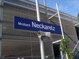
Mosbach

Point of interest after 5.3 km
Wanderbahn - Haltepunkt Lohrbach

Point of interest after 41.8 km
Eberstadter Tropfsteinhöhle

Point of interest after 48.5 km
Buchen

Point of interest after 59 km
Walldürn - Basilika

Point of interest after 64 km
Abfahrt Walldürn-Amorbach

Point of interest after 75.1 km
Amorbach - Abteikirche

Point of interest after 86.5 km
Miltenberg

Accommodation after 109.2 km
Michelstadt, Hotel Karpfen

Point of interest after 145.1 km
Michelstadt Rathaus

Point of interest after 158.9 km
Hetzbach - Himbächl-Viadukt

Point of interest after 185 km
Hirschhorn

Point of interest after 208.5 km
Ende in Heidelberg

Point of interest after 209 km
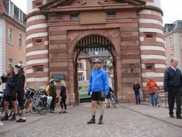
Heidelberg - Alte Brücke ENDE!
Continue with Bikemap
Use, edit, or download this cycling route
You would like to ride Kultur-Radler: vom Neckar zum Main und wieder an den Neckar or customize it for your own trip? Here is what you can do with this Bikemap route:
Free features
- Save this route as favorite or in collections
- Copy & plan your own version of this route
- Split it into stages to create a multi-day tour
- Sync your route with Garmin or Wahoo
Premium features
Free trial for 3 days, or one-time payment. More about Bikemap Premium.
- Navigate this route on iOS & Android
- Export a GPX / KML file of this route
- Create your custom printout (try it for free)
- Download this route for offline navigation
Discover more Premium features.
Get Bikemap PremiumFrom our community
Other popular routes starting in Mosbach
 Feierabend SPB 1
- Distance
- 53.7 km
- Ascent
- 680 m
- Descent
- 685 m
- Location
- Mosbach, Baden-Wurttemberg, Germany
 3-Länder-Rad-Event 2015 3ter Tag
- Distance
- 43.6 km
- Ascent
- 573 m
- Descent
- 197 m
- Location
- Mosbach, Baden-Wurttemberg, Germany
 Mosbach Mannheim
- Distance
- 85.8 km
- Ascent
- 207 m
- Descent
- 265 m
- Location
- Mosbach, Baden-Wurttemberg, Germany
 2015 Bahntrasse Mosbach nach Mudau/Odenwald
- Distance
- 50.5 km
- Ascent
- 379 m
- Descent
- 379 m
- Location
- Mosbach, Baden-Wurttemberg, Germany
 In der Hohl 6, Mosbach nach In der Hohl 6, Mosbach
- Distance
- 36.9 km
- Ascent
- 984 m
- Descent
- 977 m
- Location
- Mosbach, Baden-Wurttemberg, Germany
 Hochgeschwindigkeitsroute in
- Distance
- 25.2 km
- Ascent
- 743 m
- Descent
- 715 m
- Location
- Mosbach, Baden-Wurttemberg, Germany
 Waldkatzenbach - Mosbach
- Distance
- 60.1 km
- Ascent
- 817 m
- Descent
- 842 m
- Location
- Mosbach, Baden-Wurttemberg, Germany
 8-Freunde Dreiländertour Tag 3
- Distance
- 76.6 km
- Ascent
- 501 m
- Descent
- 537 m
- Location
- Mosbach, Baden-Wurttemberg, Germany
Open it in the app

