

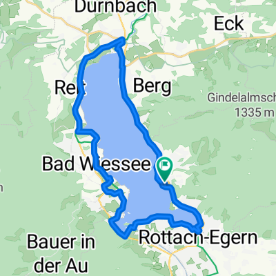
Seerundweg Tegernsee (Tour Nr. 32 aus dem"RadlTraum Süd")
- 20.9 km
- 139 m
- 140 m
- Tegernsee, Bavaria, Germany
A cycling route starting in Tegernsee, Bavaria, Germany.
Overview
Requirements based on the route: high. Long circular route (11.4 km) with flat, but also moderate and steep climbs totaling about 340 meters of elevation gain. Average energy consumption at 75 kg body weight: about 700 kcal. Requirements based on the climate: medium. The first half of the route is mainly sheltered by the forest with short, more intense sections in open areas. The return route is quite sunny and, especially in urban areas, occasionally subject to heat stress.
created this 10 years ago
Continue with Bikemap
You would like to ride Höhenweg Rottach Runde or customize it for your own trip? Here is what you can do with this Bikemap route:
Free trial for 3 days, or one-time payment. More about Bikemap Premium.
Discover more Premium features.
Get Bikemap PremiumFrom our community
Open it in the app


