

Giro del Pic de Rochebrune
A cycling route starting in Villar-Saint-Pancrace, Provence-Alpes-Côte d'Azur Region, France.
Overview
About this route
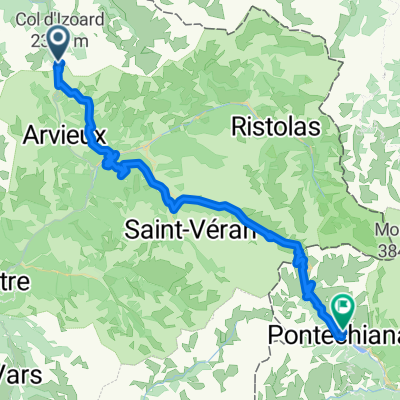
Giro del Pic de Rochebrune Clockwise
- -:--
- Duration
- 38.3 km
- Distance
- 1,825 m
- Ascent
- 1,827 m
- Descent
- ---
- Avg. speed
- ---
- Max. altitude
Continue with Bikemap
Use, edit, or download this cycling route
You would like to ride Giro del Pic de Rochebrune or customize it for your own trip? Here is what you can do with this Bikemap route:
Free features
- Save this route as favorite or in collections
- Copy & plan your own version of this route
- Sync your route with Garmin or Wahoo
Premium features
Free trial for 3 days, or one-time payment. More about Bikemap Premium.
- Navigate this route on iOS & Android
- Export a GPX / KML file of this route
- Create your custom printout (try it for free)
- Download this route for offline navigation
Discover more Premium features.
Get Bikemap PremiumFrom our community
Other popular routes starting in Villar-Saint-Pancrace
 Isoardovskej okruh
- Distance
- 85.2 km
- Ascent
- 1,604 m
- Descent
- 1,601 m
- Location
- Villar-Saint-Pancrace, Provence-Alpes-Côte d'Azur Region, France
 Briançon - Lago di Malciaussia
- Distance
- 194.1 km
- Ascent
- 4,100 m
- Descent
- 3,531 m
- Location
- Villar-Saint-Pancrace, Provence-Alpes-Côte d'Azur Region, France
 Achter de camping Prelles.
- Distance
- 16.6 km
- Ascent
- 510 m
- Descent
- 509 m
- Location
- Villar-Saint-Pancrace, Provence-Alpes-Côte d'Azur Region, France
 Col de Izoard vedlajsi
- Distance
- 93 km
- Ascent
- 1,764 m
- Descent
- 1,766 m
- Location
- Villar-Saint-Pancrace, Provence-Alpes-Côte d'Azur Region, France
 Briacon -> Sestiere
- Distance
- 73.2 km
- Ascent
- 1,833 m
- Descent
- 1,833 m
- Location
- Villar-Saint-Pancrace, Provence-Alpes-Côte d'Azur Region, France
 alpen2015-tag2
- Distance
- 44.2 km
- Ascent
- 1,232 m
- Descent
- 1,701 m
- Location
- Villar-Saint-Pancrace, Provence-Alpes-Côte d'Azur Region, France
 Col de L'Izoard - Briancon - Guillestre
- Distance
- 60.3 km
- Ascent
- 405 m
- Descent
- 1,872 m
- Location
- Villar-Saint-Pancrace, Provence-Alpes-Côte d'Azur Region, France
 0816-Napo-Pontechi
- Distance
- 54.8 km
- Ascent
- 1,949 m
- Descent
- 2,523 m
- Location
- Villar-Saint-Pancrace, Provence-Alpes-Côte d'Azur Region, France
Open it in the app