

Allgäus Trails
A cycling route starting in Nesselwang, Bavaria, Germany.
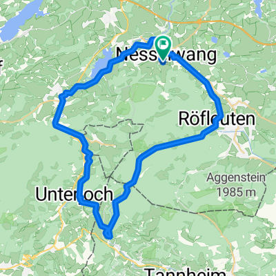
Overview
About this route
Mal was richtig hartes! Steil bergauf und bergab ein Wurzelmassaker erster Güte. Fahrtechnik (schätze ich) S4 auf der Skala S0 bis S5!
- -:--
- Duration
- 25.2 km
- Distance
- 1,128 m
- Ascent
- 1,116 m
- Descent
- ---
- Avg. speed
- ---
- Max. altitude
Continue with Bikemap
Use, edit, or download this cycling route
You would like to ride Allgäus Trails or customize it for your own trip? Here is what you can do with this Bikemap route:
Free features
- Save this route as favorite or in collections
- Copy & plan your own version of this route
- Sync your route with Garmin or Wahoo
Premium features
Free trial for 3 days, or one-time payment. More about Bikemap Premium.
- Navigate this route on iOS & Android
- Export a GPX / KML file of this route
- Create your custom printout (try it for free)
- Download this route for offline navigation
Discover more Premium features.
Get Bikemap PremiumFrom our community
Other popular routes starting in Nesselwang
 Nesselwang - Faistenoy - Oberelleg - Petersthal und zurück
- Distance
- 32 km
- Ascent
- 1,442 m
- Descent
- 1,488 m
- Location
- Nesselwang, Bavaria, Germany
 Nesselwang - Wertachtal - Schwarzenberg - Seemoos - Maria Rain
- Distance
- 21.9 km
- Ascent
- 529 m
- Descent
- 532 m
- Location
- Nesselwang, Bavaria, Germany
 Allgäu- Tannheimer Tal
- Distance
- 79.6 km
- Ascent
- 846 m
- Descent
- 851 m
- Location
- Nesselwang, Bavaria, Germany
 Ins benachbarte Tannheimer Tal
- Distance
- 41.4 km
- Ascent
- 349 m
- Descent
- 347 m
- Location
- Nesselwang, Bavaria, Germany
 Die schöne Allgäuerin
- Distance
- 90.6 km
- Ascent
- 983 m
- Descent
- 983 m
- Location
- Nesselwang, Bavaria, Germany
 Nesselwang - Grüntensee - Oberellegg und zurück
- Distance
- 25.3 km
- Ascent
- 883 m
- Descent
- 883 m
- Location
- Nesselwang, Bavaria, Germany
 Allgäus Trails
- Distance
- 25.2 km
- Ascent
- 1,128 m
- Descent
- 1,116 m
- Location
- Nesselwang, Bavaria, Germany
 2 Drei-Täler-Radtour Allgäu-Tirol
- Distance
- 66.8 km
- Ascent
- 590 m
- Descent
- 590 m
- Location
- Nesselwang, Bavaria, Germany
Open it in the app