

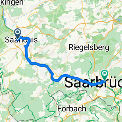
15.07.26 Saarlouis-Blieskastel
A cycling route starting in Saarlouis, Saarland, Germany.
Overview
About this route
de http://www.bikemap.net/de/route/3255327-150725-palzem-saarlouis/Mostly along the Saar Cycle Route or the former railway line of the Blies Cycle Route.to http://www.bikemap.net/de/route/3257307-150727-blieskastel-wiesweiler/
- -:--
- Duration
- 79.4 km
- Distance
- 214 m
- Ascent
- 87 m
- Descent
- ---
- Avg. speed
- ---
- Max. altitude

Route quality
Waytypes & surfaces along the route
Waytypes
Access road
34.9 km
(44 %)
Path
14.3 km
(18 %)
Surfaces
Paved
73.1 km
(92 %)
Unpaved
0.8 km
(1 %)
Asphalt
65.1 km
(82 %)
Paved (undefined)
4 km
(5 %)
Route highlights
Points of interest along the route
Point of interest after 67.2 km
Schöne Radlerraststation !
Point of interest after 78.3 km
Tolle Eisdiele.
Continue with Bikemap
Use, edit, or download this cycling route
You would like to ride 15.07.26 Saarlouis-Blieskastel or customize it for your own trip? Here is what you can do with this Bikemap route:
Free features
- Save this route as favorite or in collections
- Copy & plan your own version of this route
- Sync your route with Garmin or Wahoo
Premium features
Free trial for 3 days, or one-time payment. More about Bikemap Premium.
- Navigate this route on iOS & Android
- Export a GPX / KML file of this route
- Create your custom printout (try it for free)
- Download this route for offline navigation
Discover more Premium features.
Get Bikemap PremiumFrom our community
Other popular routes starting in Saarlouis
 Teufelrunde 2
- Distance
- 34.6 km
- Ascent
- 601 m
- Descent
- 677 m
- Location
- Saarlouis, Saarland, Germany
 Gau-Schengen
- Distance
- 137.6 km
- Ascent
- 896 m
- Descent
- 896 m
- Location
- Saarlouis, Saarland, Germany
 15.07.26 Saarlouis-Blieskastel
- Distance
- 79.4 km
- Ascent
- 214 m
- Descent
- 87 m
- Location
- Saarlouis, Saarland, Germany
 Saarlouis - Saarbrücken - 3
- Distance
- 28.5 km
- Ascent
- 215 m
- Descent
- 190 m
- Location
- Saarlouis, Saarland, Germany
 Links der Saar Permanente
- Distance
- 83.6 km
- Ascent
- 0 m
- Descent
- 0 m
- Location
- Saarlouis, Saarland, Germany
 Saartal Touristik Fraulautern 2009 - RTF des RSV 1907 Saarlouis-Fraulautern e.V. - 45 km Strecke
- Distance
- 46.9 km
- Ascent
- 298 m
- Descent
- 295 m
- Location
- Saarlouis, Saarland, Germany
 Saartal Touristik Fraulautern 2009 - RTF des RSV 1907 Saarlouis-Fraulautern e.V. - 77 km Strecke
- Distance
- 74.8 km
- Ascent
- 558 m
- Descent
- 544 m
- Location
- Saarlouis, Saarland, Germany
 Saarlouis/Merzig Rive gauche
- Distance
- 19.7 km
- Ascent
- 139 m
- Descent
- 149 m
- Location
- Saarlouis, Saarland, Germany
Open it in the app