

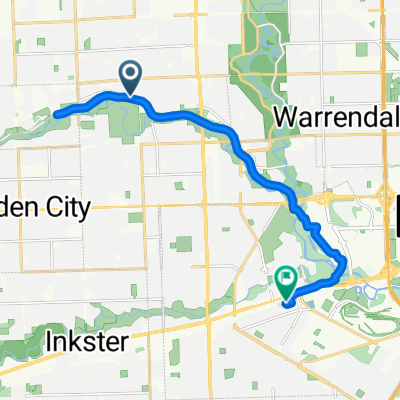
Dearborn to Grand Rapids
A cycling route starting in Dearborn Heights, Michigan, United States.
Overview
About this route
League of Michigan Bicyclists Detroit to Muskegon route condensed into Dearborn to Meijer Gardens in Grand Rapids
- -:--
- Duration
- 286.6 km
- Distance
- 313 m
- Ascent
- 255 m
- Descent
- ---
- Avg. speed
- ---
- Max. altitude
Route quality
Waytypes & surfaces along the route
Waytypes
Road
169.7 km
(59 %)
Quiet road
60.5 km
(21 %)
Surfaces
Paved
171.8 km
(60 %)
Unpaved
2.8 km
(<1 %)
Asphalt
114 km
(40 %)
Paved (undefined)
55.7 km
(19 %)
Continue with Bikemap
Use, edit, or download this cycling route
You would like to ride Dearborn to Grand Rapids or customize it for your own trip? Here is what you can do with this Bikemap route:
Free features
- Save this route as favorite or in collections
- Copy & plan your own version of this route
- Split it into stages to create a multi-day tour
- Sync your route with Garmin or Wahoo
Premium features
Free trial for 3 days, or one-time payment. More about Bikemap Premium.
- Navigate this route on iOS & Android
- Export a GPX / KML file of this route
- Create your custom printout (try it for free)
- Download this route for offline navigation
Discover more Premium features.
Get Bikemap PremiumFrom our community
Other popular routes starting in Dearborn Heights
 25770–26106 Edward N Hines Dr, Dearborn Heights to 22214 Abbey Ln, Dearborn
- Distance
- 14.6 km
- Ascent
- 682 m
- Descent
- 685 m
- Location
- Dearborn Heights, Michigan, United States
 710 N Highland St, Dearborn to 34065 Standish St, Westland
- Distance
- 12 km
- Ascent
- 17 m
- Descent
- 9 m
- Location
- Dearborn Heights, Michigan, United States
 Moderate route in Dearborn
- Distance
- 47.6 km
- Ascent
- 251 m
- Descent
- 250 m
- Location
- Dearborn Heights, Michigan, United States
 bike riding with Abdo
- Distance
- 22.6 km
- Ascent
- 93 m
- Descent
- 94 m
- Location
- Dearborn Heights, Michigan, United States
 1055 N Silvery Ln, Dearborn to 903 N Vernon St, Dearborn
- Distance
- 4.8 km
- Ascent
- 0 m
- Descent
- 0 m
- Location
- Dearborn Heights, Michigan, United States
 Hines Park Trail
- Distance
- 39.5 km
- Ascent
- 291 m
- Descent
- 191 m
- Location
- Dearborn Heights, Michigan, United States
 933 N Mildred St, Dearborn to 925 N Mildred St, Dearborn
- Distance
- 27.1 km
- Ascent
- 82 m
- Descent
- 271 m
- Location
- Dearborn Heights, Michigan, United States
 HINES DRIVE
- Distance
- 17.4 km
- Ascent
- 65 m
- Descent
- 40 m
- Location
- Dearborn Heights, Michigan, United States
Open it in the app