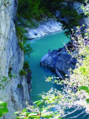
45_Von Füssen nach Schongau
A cycling route starting in Füssen, Bavaria, Germany.
Overview
About this route
Cycling in the land of King Ludwig II of Bavaria Character: Until Trauchgau relatively flat, via Wieskirche and Steingaden to Schongau many short climbs. The paths are paved or have a solid surface. Traffic: In Füssen, Peiting, and Schongau also on roads with heavy motor vehicle traffic. Otherwise, there are cycling paths alongside roads, low-traffic secondary roads, and agricultural paths. Suitable travel guide: KOMPASS 6424 Lechtal, Ralf Enke, ISBN 978-3-85026-410-5
- -:--
- Duration
- 56.1 km
- Distance
- 340 m
- Ascent
- 447 m
- Descent
- ---
- Avg. speed
- ---
- Max. altitude
Route quality
Waytypes & surfaces along the route
Waytypes
Quiet road
32 km
(57 %)
Path
10.1 km
(18 %)
Surfaces
Paved
51.1 km
(91 %)
Unpaved
2.8 km
(5 %)
Asphalt
49.4 km
(88 %)
Paved (undefined)
1.7 km
(3 %)
Route highlights
Points of interest along the route

Point of interest after 0 km
Füssen: Die Schlucht des Lech: Wer sich im Königswinkel der Stadt Füssen nähert, erblickt als erstes das Hohe Schloss und das Kloster St. Mang. Unterhalb der Burganlage liegt die mittelalterliche Altstadt mit ihren engen Gassen und Winkeln. Füssen aber ist noch viel älter: Als römischer Militärposte

Point of interest after 4.7 km
Schloss Hohenschwangau: Das Schloss Hohenschwangau war einst die Burg der Edlen von Schwangau. Häufig wurde sie zerstört und wieder aufgebaut. 1832 erwarb König Maximilian II. die Burg und ließ sie bis 1836 zum Schloss umbauen. Bild-/ Textquelle: KOMPASS Verlag

Point of interest after 29.1 km
Die Wieskirche in Wies bei Steingaden: Das Gotteshaus heißt eigentlich Wallfahrtskirche „Zum gegeißelten Heiland auf der Wies“ und ist das Meisterwerk der Gebrüder Zimmermann, das beide 1745 bis 1754 erbauten. Zur Wallfahrtskirche wurde sie, als die Bäuerin Maria Lory vom Wieshof während eines abend
Continue with Bikemap
Use, edit, or download this cycling route
You would like to ride 45_Von Füssen nach Schongau or customize it for your own trip? Here is what you can do with this Bikemap route:
Free features
- Save this route as favorite or in collections
- Copy & plan your own version of this route
- Sync your route with Garmin or Wahoo
Premium features
Free trial for 3 days, or one-time payment. More about Bikemap Premium.
- Navigate this route on iOS & Android
- Export a GPX / KML file of this route
- Create your custom printout (try it for free)
- Download this route for offline navigation
Discover more Premium features.
Get Bikemap PremiumFrom our community
Other popular routes starting in Füssen
 Füssener Seenrunde
- Distance
- 29.3 km
- Ascent
- 288 m
- Descent
- 270 m
- Location
- Füssen, Bavaria, Germany
 Füssen - Italien ---> Andy und Jenny
- Distance
- 436.5 km
- Ascent
- 1,309 m
- Descent
- 2,038 m
- Location
- Füssen, Bavaria, Germany
 Hopfen - Neuschwanstein
- Distance
- 28.8 km
- Ascent
- 244 m
- Descent
- 244 m
- Location
- Füssen, Bavaria, Germany
 Forggenseerunde
- Distance
- 30.1 km
- Ascent
- 234 m
- Descent
- 234 m
- Location
- Füssen, Bavaria, Germany
 Füssen nach Venedig (Via Claudia Augusta) CLONED FROM ROUTE 313946
- Distance
- 591.7 km
- Ascent
- 2,777 m
- Descent
- 3,576 m
- Location
- Füssen, Bavaria, Germany
 BGA40_RundeAlatsee
- Distance
- 14.5 km
- Ascent
- 560 m
- Descent
- 558 m
- Location
- Füssen, Bavaria, Germany
 Tannheimer Tal
- Distance
- 61.8 km
- Ascent
- 648 m
- Descent
- 636 m
- Location
- Füssen, Bavaria, Germany
 45_Von Füssen nach Schongau
- Distance
- 56.1 km
- Ascent
- 340 m
- Descent
- 447 m
- Location
- Füssen, Bavaria, Germany
Open it in the app


