


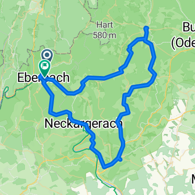
Eberbach - Mudau Rundweg
- 83.6 km
- 1,399 m
- 1,414 m
- Eberbach, Baden-Wurttemberg, Germany
A cycling route starting in Eberbach, Baden-Wurttemberg, Germany.
Overview
Castles, palaces, and squares on the way to the Rhine Character: Easy downhill ride with minor intermediate ascents on asphalt and gravel paths. Traffic: Predominantly car-free or public transport prohibited economic paths, only a short stretch of cycle path beside a federal highway. Suitable travel guide: KOMPASS 6282 Neckartal-Radweg, Bernhard Pollmann, ISBN 978-3-85026-757-1
created this 10 years ago
Route quality
Track
17.5 km
(31 %)
Path
13 km
(23 %)
Paved
40.7 km
(72 %)
Unpaved
12.4 km
(22 %)
Asphalt
39.6 km
(70 %)
Gravel
7.9 km
(14 %)
Route highlights

Dilsberg: Die mittelalterliche Burg auf dem Dilsberg blieb unerobert und wurde bis ins 18. Jh. zur Festung ausgebaut. Die architektonisch einer Krone nachempfundene Festungsmauer schützte 700 Menschen innerhalb der Bergstadt. Zusammen mit den vier Burgen von Neckarsteinach am gegenüberliegenden Flus

Heidelberg: Universitätsstadt am Neckar, ehemalige Residenz der Kurpfalz mit der Ruine des 1689 von den Franzosen zerstörten Renaissanceschlosses im Hang des Königstuhls (Bergbahn). Heidelbergs weltweite Bekanntheit als eine der schönsten Städte Deutschlands gründet in der seit der Romantik besunge

Mannheim: Mannheim an der Mündung des Neckars in den Rhein ist die zweitgrößte Stadt Baden-Württembergs (0,3 Mio. Ew.), Universitätsstadt, ehemalige Residenz der Kurpfalz und seit dem 19. Jh. Wirtschafts- und Hochtechnologiezentrum. Die hufeisenförmige Innenstadt zwischen Rhein und Neckar ist als Gi
Continue with Bikemap
You would like to ride 38_Eberbach – Heidelberg – Mannheim or customize it for your own trip? Here is what you can do with this Bikemap route:
Free trial for 3 days, or one-time payment. More about Bikemap Premium.
Discover more Premium features.
Get Bikemap PremiumFrom our community
Open it in the app


