

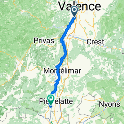
STB_Barca_act_008_0812_Valence_Orange
A cycling route starting in Soyons, Auvergne-Rhône-Alpes, France.
Overview
About this route
Etappe 8 im Rhonetal. War ziemlich heiß. In Orange Deutsch an der Rezeption :-)
- -:--
- Duration
- 112.1 km
- Distance
- 278 m
- Ascent
- 321 m
- Descent
- ---
- Avg. speed
- ---
- Max. altitude

Route quality
Waytypes & surfaces along the route
Waytypes
Quiet road
21.3 km
(19 %)
Road
11.2 km
(10 %)
Surfaces
Paved
61.7 km
(55 %)
Unpaved
1.1 km
(1 %)
Asphalt
61.7 km
(55 %)
Gravel
1.1 km
(1 %)
Undefined
49.3 km
(44 %)
Continue with Bikemap
Use, edit, or download this cycling route
You would like to ride STB_Barca_act_008_0812_Valence_Orange or customize it for your own trip? Here is what you can do with this Bikemap route:
Free features
- Save this route as favorite or in collections
- Copy & plan your own version of this route
- Split it into stages to create a multi-day tour
- Sync your route with Garmin or Wahoo
Premium features
Free trial for 3 days, or one-time payment. More about Bikemap Premium.
- Navigate this route on iOS & Android
- Export a GPX / KML file of this route
- Create your custom printout (try it for free)
- Download this route for offline navigation
Discover more Premium features.
Get Bikemap PremiumFrom our community
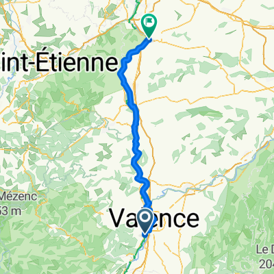
Other popular routes starting in Soyons
 2016 Ride Day 153 - Valence to Donzère
- Distance
- 78.7 km
- Ascent
- 456 m
- Descent
- 504 m
- Location
- Soyons, Auvergne-Rhône-Alpes, France
 Toulaud -St Peray 19,5 kms
- Distance
- 19.4 km
- Ascent
- 340 m
- Descent
- 336 m
- Location
- Soyons, Auvergne-Rhône-Alpes, France
 Soyons - Bourg-Saint-Andéol
- Distance
- 78.5 km
- Ascent
- 277 m
- Descent
- 333 m
- Location
- Soyons, Auvergne-Rhône-Alpes, France
 03 Soyons to Vienne 100
- Distance
- 100.2 km
- Ascent
- 367 m
- Descent
- 316 m
- Location
- Soyons, Auvergne-Rhône-Alpes, France
 1 Soyons - Viviers
- Distance
- 64.2 km
- Ascent
- 140 m
- Descent
- 185 m
- Location
- Soyons, Auvergne-Rhône-Alpes, France
 STB_Barca_act_008_0812_Valence_Orange
- Distance
- 112.1 km
- Ascent
- 278 m
- Descent
- 321 m
- Location
- Soyons, Auvergne-Rhône-Alpes, France
 1 Chemin des Sportifs, Soyons to Rue de l'Hôtel de Ville, Le Pouzin
- Distance
- 24 km
- Ascent
- 76 m
- Descent
- 82 m
- Location
- Soyons, Auvergne-Rhône-Alpes, France
 Valences-Montpellier
- Distance
- 198.7 km
- Ascent
- 865 m
- Descent
- 942 m
- Location
- Soyons, Auvergne-Rhône-Alpes, France
Open it in the app