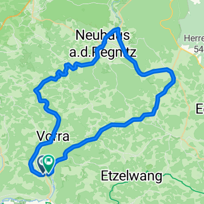
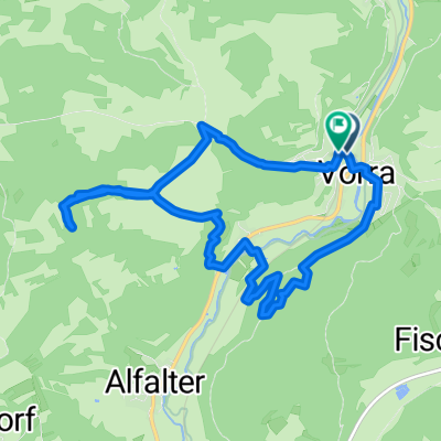
Vorra_Pielenhofen
A cycling route starting in Vorra, Bavaria, Germany.
Overview
About this route
Cycling route from Vorra to Pielenhofen
- -:--
- Duration
- 85.1 km
- Distance
- 393 m
- Ascent
- 418 m
- Descent
- ---
- Avg. speed
- ---
- Max. altitude
Route quality
Waytypes & surfaces along the route
Waytypes
Quiet road
31.5 km
(37 %)
Cycleway
19.6 km
(23 %)
Surfaces
Paved
66.4 km
(78 %)
Unpaved
11.9 km
(14 %)
Asphalt
64.7 km
(76 %)
Unpaved (undefined)
6.8 km
(8 %)
Continue with Bikemap
Use, edit, or download this cycling route
You would like to ride Vorra_Pielenhofen or customize it for your own trip? Here is what you can do with this Bikemap route:
Free features
- Save this route as favorite or in collections
- Copy & plan your own version of this route
- Split it into stages to create a multi-day tour
- Sync your route with Garmin or Wahoo
Premium features
Free trial for 3 days, or one-time payment. More about Bikemap Premium.
- Navigate this route on iOS & Android
- Export a GPX / KML file of this route
- Create your custom printout (try it for free)
- Download this route for offline navigation
Discover more Premium features.
Get Bikemap PremiumFrom our community
Other popular routes starting in Vorra
- Bahnhofstraße 12, Vorra nach Bahnhofstraße 4a, Vorra
- Distance
- 14 km
- Ascent
- 55 m
- Descent
- 53 m
- Location
- Vorra, Bavaria, Germany
- Eschenbach-Etzelwang
- Distance
- 39.4 km
- Ascent
- 211 m
- Descent
- 210 m
- Location
- Vorra, Bavaria, Germany
- 2012 Pegnitzradweg-RotMain Radweg-Bayreuth
- Distance
- 78.4 km
- Ascent
- 438 m
- Descent
- 494 m
- Location
- Vorra, Bavaria, Germany
- Hirschbachtal
- Distance
- 19 km
- Ascent
- 458 m
- Descent
- 463 m
- Location
- Vorra, Bavaria, Germany
- Artelshofen - Wander 1
- Distance
- 5.7 km
- Ascent
- 143 m
- Descent
- 143 m
- Location
- Vorra, Bavaria, Germany
- Vorra nach Lauf
- Distance
- 25.5 km
- Ascent
- 72 m
- Descent
- 102 m
- Location
- Vorra, Bavaria, Germany
- Eschenbach-Etzelwang
- Distance
- 24.3 km
- Ascent
- 211 m
- Descent
- 213 m
- Location
- Vorra, Bavaria, Germany
- Jura Gebirgsweg - Gelbkreuz
- Distance
- 42.8 km
- Ascent
- 1,100 m
- Descent
- 958 m
- Location
- Vorra, Bavaria, Germany
Open it in the app