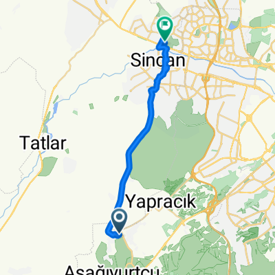
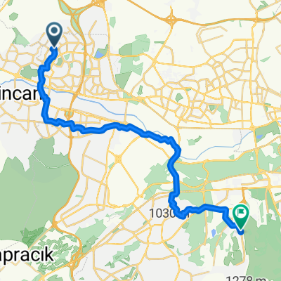
Seker-Kazan
A cycling route starting in Etimesgut, Ankara Province, Republic of Türkiye.
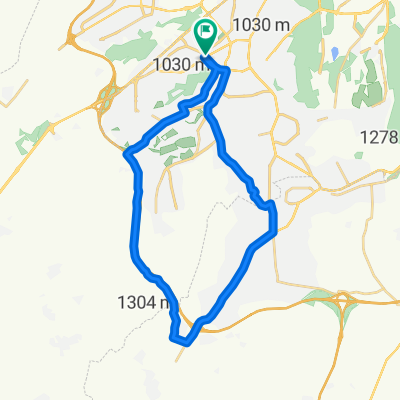
Overview
About this route
Road bike, easy training
- -:--
- Duration
- 40.5 km
- Distance
- 338 m
- Ascent
- 185 m
- Descent
- ---
- Avg. speed
- ---
- Max. altitude
Route quality
Waytypes & surfaces along the route
Waytypes
Cycleway
27.9 km
(69 %)
Quiet road
8.1 km
(20 %)
Surfaces
Paved
2.8 km
(7 %)
Asphalt
2.8 km
(7 %)
Undefined
37.6 km
(93 %)
Continue with Bikemap
Use, edit, or download this cycling route
You would like to ride Seker-Kazan or customize it for your own trip? Here is what you can do with this Bikemap route:
Free features
- Save this route as favorite or in collections
- Copy & plan your own version of this route
- Sync your route with Garmin or Wahoo
Premium features
Free trial for 3 days, or one-time payment. More about Bikemap Premium.
- Navigate this route on iOS & Android
- Export a GPX / KML file of this route
- Create your custom printout (try it for free)
- Download this route for offline navigation
Discover more Premium features.
Get Bikemap PremiumFrom our community
Other popular routes starting in Etimesgut
Çayyolu Yapracık Türkobası Malıköy Çayyolu- Distance
- 68 km
- Ascent
- 725 m
- Descent
- 725 m
- Location
- Etimesgut, Ankara Province, Republic of Türkiye
Cumhuriyet Rotası- Distance
- 76.7 km
- Ascent
- 583 m
- Descent
- 580 m
- Location
- Etimesgut, Ankara Province, Republic of Türkiye
Gezi Güzergahı- Distance
- 2,237.8 km
- Ascent
- 3,992 m
- Descent
- 3,553 m
- Location
- Etimesgut, Ankara Province, Republic of Türkiye
Alacatlı Köyü Elmalı Mevki Sokak 1141 B to Alacatlı Köyü Elmalı Mevki Sokak 1141 B- Distance
- 14 km
- Ascent
- 285 m
- Descent
- 283 m
- Location
- Etimesgut, Ankara Province, Republic of Türkiye
Hacı Toğrul Baba Türbesi, Külhöyük, Büyük Tümülüs- Distance
- 53.9 km
- Ascent
- 629 m
- Descent
- 355 m
- Location
- Etimesgut, Ankara Province, Republic of Türkiye
Bağlıca Bulvarı to Dumlupınar 30 Ağustos Caddesi 2- Distance
- 20.7 km
- Ascent
- 69 m
- Descent
- 131 m
- Location
- Etimesgut, Ankara Province, Republic of Türkiye
mahalle turu- Distance
- 4.9 km
- Ascent
- 14 m
- Descent
- 13 m
- Location
- Etimesgut, Ankara Province, Republic of Türkiye
Çayyolu-Ümitköy-Park Cd- Distance
- 13.3 km
- Ascent
- 140 m
- Descent
- 137 m
- Location
- Etimesgut, Ankara Province, Republic of Türkiye
Open it in the app

