

09-09-2013_Day06
A cycling route starting in Ōmachi, Nagano, Japan.
Overview
About this route
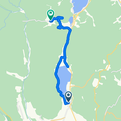
09-09-2013_Day06
長野 大町市 木崎湖 -> 長野 白馬村 Omachi, Nagano -> Hakuba, Nagano- -:--
- Duration
- 24.5 km
- Distance
- 219 m
- Ascent
- 304 m
- Descent
- ---
- Avg. speed
- ---
- Max. altitude

Continue with Bikemap
Use, edit, or download this cycling route
You would like to ride 09-09-2013_Day06 or customize it for your own trip? Here is what you can do with this Bikemap route:
Free features
- Save this route as favorite or in collections
- Copy & plan your own version of this route
- Sync your route with Garmin or Wahoo
Premium features
Free trial for 3 days, or one-time payment. More about Bikemap Premium.
- Navigate this route on iOS & Android
- Export a GPX / KML file of this route
- Create your custom printout (try it for free)
- Download this route for offline navigation
Discover more Premium features.
Get Bikemap PremiumFrom our community
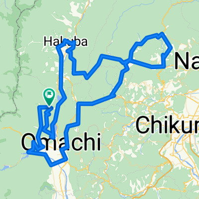
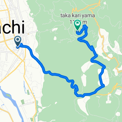
Other popular routes starting in Ōmachi
 09-09-2013_Day06
- Distance
- 24.5 km
- Ascent
- 219 m
- Descent
- 304 m
- Location
- Ōmachi, Nagano, Japan
 安曇野~白馬②
- Distance
- 69.5 km
- Ascent
- 674 m
- Descent
- 678 m
- Location
- Ōmachi, Nagano, Japan
 中綱林道コース
- Distance
- 11.3 km
- Ascent
- 470 m
- Descent
- 98 m
- Location
- Ōmachi, Nagano, Japan
 鷹狩山コース
- Distance
- 5.6 km
- Ascent
- 460 m
- Descent
- 25 m
- Location
- Ōmachi, Nagano, Japan
 0827大町-上越110km
- Distance
- 109.9 km
- Ascent
- 816 m
- Descent
- 1,527 m
- Location
- Ōmachi, Nagano, Japan
 2020 北アルプス山麓グランフォンド 160㎞
- Distance
- 143.5 km
- Ascent
- 4,497 m
- Descent
- 4,500 m
- Location
- Ōmachi, Nagano, Japan
 裏鷹狩コース
- Distance
- 9.4 km
- Ascent
- 540 m
- Descent
- 105 m
- Location
- Ōmachi, Nagano, Japan
 青木湖・中綱湖ポタリング
- Distance
- 8.9 km
- Ascent
- 169 m
- Descent
- 169 m
- Location
- Ōmachi, Nagano, Japan
Open it in the app