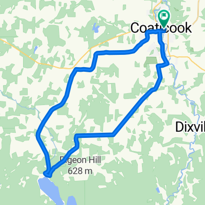
Compton - Ayers Cliff - North Hatley
A cycling route starting in Coaticook, Quebec, Canada.
Overview
About this route
À faire!
- -:--
- Duration
- 62 km
- Distance
- 554 m
- Ascent
- 556 m
- Descent
- ---
- Avg. speed
- ---
- Max. altitude
Route quality
Waytypes & surfaces along the route
Waytypes
Road
18.6 km
(30 %)
Quiet road
9.3 km
(15 %)
Surfaces
Paved
52.1 km
(84 %)
Unpaved
8.1 km
(13 %)
Asphalt
44.6 km
(72 %)
Unpaved (undefined)
8.1 km
(13 %)
Continue with Bikemap
Use, edit, or download this cycling route
You would like to ride Compton - Ayers Cliff - North Hatley or customize it for your own trip? Here is what you can do with this Bikemap route:
Free features
- Save this route as favorite or in collections
- Copy & plan your own version of this route
- Sync your route with Garmin or Wahoo
Premium features
Free trial for 3 days, or one-time payment. More about Bikemap Premium.
- Navigate this route on iOS & Android
- Export a GPX / KML file of this route
- Create your custom printout (try it for free)
- Download this route for offline navigation
Discover more Premium features.
Get Bikemap PremiumFrom our community
Other popular routes starting in Coaticook
From Coaticook to Mount Vernon- Distance
- 253 km
- Ascent
- 4,706 m
- Descent
- 4,898 m
- Location
- Coaticook, Quebec, Canada
Compton et cie- Distance
- 85.5 km
- Ascent
- 762 m
- Descent
- 764 m
- Location
- Coaticook, Quebec, Canada
Compton dans les côtes- Distance
- 76.5 km
- Ascent
- 687 m
- Descent
- 687 m
- Location
- Coaticook, Quebec, Canada
Boucle de Compton- Distance
- 45.5 km
- Ascent
- 522 m
- Descent
- 505 m
- Location
- Coaticook, Quebec, Canada
Compton- Distance
- 73.8 km
- Ascent
- 800 m
- Descent
- 735 m
- Location
- Coaticook, Quebec, Canada
Coaticook - Lyster- Distance
- 34.4 km
- Ascent
- 390 m
- Descent
- 390 m
- Location
- Coaticook, Quebec, Canada
Circuit Vallée de la Coaticook- Distance
- 112.1 km
- Ascent
- 1,020 m
- Descent
- 1,026 m
- Location
- Coaticook, Quebec, Canada
Coaticook - St Edwidge - Moose River - Compton - Coaticook- Distance
- 51.4 km
- Ascent
- 563 m
- Descent
- 563 m
- Location
- Coaticook, Quebec, Canada
Open it in the app

