

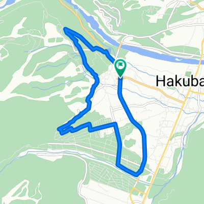
09-10-2013_Day07
A cycling route starting in Hakuba, Nagano, Japan.
Overview
About this route
09-10-2013_Day07
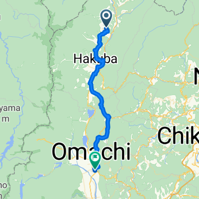
長野 白馬村 -> 新瀉 上越市 Hakuba, Nagano -> Joetsu, Niigata 長野 白馬村 -> 長野市 -> 信濃町 -> 妙高市 -> 新瀉 上越市- -:--
- Duration
- 109.6 km
- Distance
- 1,084 m
- Ascent
- 1,754 m
- Descent
- ---
- Avg. speed
- ---
- Max. altitude

Continue with Bikemap
Use, edit, or download this cycling route
You would like to ride 09-10-2013_Day07 or customize it for your own trip? Here is what you can do with this Bikemap route:
Free features
- Save this route as favorite or in collections
- Copy & plan your own version of this route
- Split it into stages to create a multi-day tour
- Sync your route with Garmin or Wahoo
Premium features
Free trial for 3 days, or one-time payment. More about Bikemap Premium.
- Navigate this route on iOS & Android
- Export a GPX / KML file of this route
- Create your custom printout (try it for free)
- Download this route for offline navigation
Discover more Premium features.
Get Bikemap PremiumFrom our community
Other popular routes starting in Hakuba
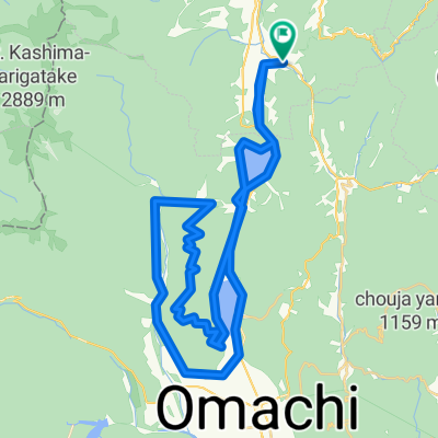 Nishina three lakes and Mt.Koguma Hill Climb
- Distance
- 57.1 km
- Ascent
- 1,294 m
- Descent
- 1,299 m
- Location
- Hakuba, Nagano, Japan
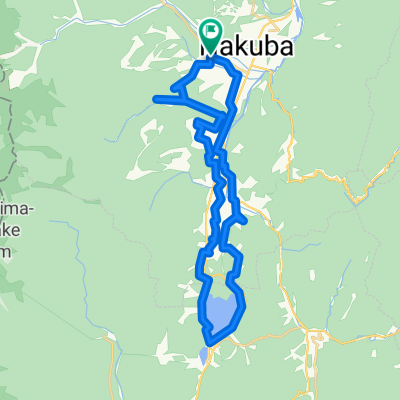
 ヒルクライム 白沢峠コース
- Distance
- 7.7 km
- Ascent
- 454 m
- Descent
- 44 m
- Location
- Hakuba, Nagano, Japan
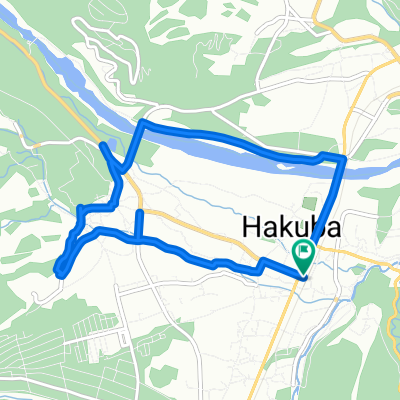
 八方コース
八方コース- Distance
- 10.4 km
- Ascent
- 180 m
- Descent
- 182 m
- Location
- Hakuba, Nagano, Japan
 CHARIP Rhythm_HAKUBA 250708
- Distance
- 35.5 km
- Ascent
- 421 m
- Descent
- 420 m
- Location
- Hakuba, Nagano, Japan
 Scenic Short Spots Route
- Distance
- 8.8 km
- Ascent
- 109 m
- Descent
- 107 m
- Location
- Hakuba, Nagano, Japan
 歴史が薫る田園風景ルート
- Distance
- 43.4 km
- Ascent
- 931 m
- Descent
- 1,095 m
- Location
- Hakuba, Nagano, Japan
 Rural Scene Along the Hime River
- Distance
- 12.1 km
- Ascent
- 122 m
- Descent
- 123 m
- Location
- Hakuba, Nagano, Japan
 五竜コース
五竜コース- Distance
- 8.8 km
- Ascent
- 117 m
- Descent
- 115 m
- Location
- Hakuba, Nagano, Japan
Open it in the app