

Dingolfing - Greilsberg und zurück
A cycling route starting in Dingolfing, Bavaria, Germany.
Overview
About this route
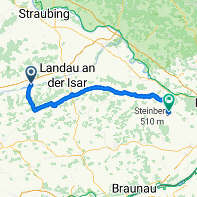
From Plus via Brumatherstraße into the new industrial area up to the roundabout at AVP. Following the cycle path to Höfen at Teisbacher Hof. Turning right towards Dornwang. Continue to Rimbach and Dreifaltigkeitsberg. Opportunity for a break. Continuing towards Hösacker and crossing the main road to Veitsbuch (left), or Mühlhausen (right) towards Raffach. Follow this asphalted road until the tarmac ends. Ride along the paved gravel road for a short distance and then keep right. Follow the course of this road until it briefly forks at a junction. Following the left branch and descending towards Feuchten. In Feuchten, turn right towards Bayerbach and stay on this road until Penk and Greilsberg. In Greilsberg, there is an excellent opportunity for a break. From Greilsberg continue to Heimelkofen and follow the sign (right) to Leitersdorf and Asbach. The route goes through these two villages up to Ginhart. Also pass through Ginhart and then turn left towards Hagenau, Süßkofen. In Süßkofen then turn right towards Steinbach and Mühlhausen. Pass through Mühlhausen towards Ottending. After Ottending, travel a short stretch towards Dreifaltigkeitsberg and then turn (left) to Neukreuth. Following the road, you will reach Rimbach again, from where you can either return as you came or take the path through the moos towards Kronwieden. In Kronwieden, after the railroad crossing, turn right and the beginning of the cycle path (200m) leads back to the starting point.
- -:--
- Duration
- 47.4 km
- Distance
- 452 m
- Ascent
- 410 m
- Descent
- ---
- Avg. speed
- 493 m
- Max. altitude
Route quality
Waytypes & surfaces along the route
Waytypes
Road
23.2 km
(49 %)
Quiet road
16.6 km
(35 %)
Surfaces
Paved
14.2 km
(30 %)
Unpaved
2.8 km
(6 %)
Asphalt
14.2 km
(30 %)
Loose gravel
1.4 km
(3 %)
Continue with Bikemap
Use, edit, or download this cycling route
You would like to ride Dingolfing - Greilsberg und zurück or customize it for your own trip? Here is what you can do with this Bikemap route:
Free features
- Save this route as favorite or in collections
- Copy & plan your own version of this route
- Sync your route with Garmin or Wahoo
Premium features
Free trial for 3 days, or one-time payment. More about Bikemap Premium.
- Navigate this route on iOS & Android
- Export a GPX / KML file of this route
- Create your custom printout (try it for free)
- Download this route for offline navigation
Discover more Premium features.
Get Bikemap PremiumFrom our community
Other popular routes starting in Dingolfing
 Dingolfing nach Marktplatz
- Distance
- 79.2 km
- Ascent
- 407 m
- Descent
- 416 m
- Location
- Dingolfing, Bavaria, Germany
 Dingolfing - Garching
- Distance
- 96.2 km
- Ascent
- 518 m
- Descent
- 389 m
- Location
- Dingolfing, Bavaria, Germany
 Ostwindstrecke
- Distance
- 58.4 km
- Ascent
- 328 m
- Descent
- 325 m
- Location
- Dingolfing, Bavaria, Germany
 Sonntagsrunde MTB
- Distance
- 31.4 km
- Ascent
- 201 m
- Descent
- 203 m
- Location
- Dingolfing, Bavaria, Germany
 Hartlwirt_Hintour
- Distance
- 18.1 km
- Ascent
- 103 m
- Descent
- 81 m
- Location
- Dingolfing, Bavaria, Germany
 Dingolfing - Tiefenbach
- Distance
- 72.7 km
- Ascent
- 325 m
- Descent
- 377 m
- Location
- Dingolfing, Bavaria, Germany
 Dingolfing - Greilsberg und zurück
- Distance
- 47.4 km
- Ascent
- 452 m
- Descent
- 410 m
- Location
- Dingolfing, Bavaria, Germany
 zum Ghs.. zur Post Griesbach
- Distance
- 14.1 km
- Ascent
- 182 m
- Descent
- 122 m
- Location
- Dingolfing, Bavaria, Germany
Open it in the app