

Porzerrunde 3/1
A cycling route starting in Obertilliach, Tyrol, Austria.
Overview
About this route
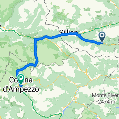
Porzerrunde 3/1 Day: Obertiliach - Sappada
- -:--
- Duration
- 43.5 km
- Distance
- 1,355 m
- Ascent
- 1,554 m
- Descent
- ---
- Avg. speed
- ---
- Max. altitude
Continue with Bikemap
Use, edit, or download this cycling route
You would like to ride Porzerrunde 3/1 or customize it for your own trip? Here is what you can do with this Bikemap route:
Free features
- Save this route as favorite or in collections
- Copy & plan your own version of this route
- Sync your route with Garmin or Wahoo
Premium features
Free trial for 3 days, or one-time payment. More about Bikemap Premium.
- Navigate this route on iOS & Android
- Export a GPX / KML file of this route
- Create your custom printout (try it for free)
- Download this route for offline navigation
Discover more Premium features.
Get Bikemap PremiumFrom our community
Other popular routes starting in Obertilliach
 Obertiliah - Lago di Creta
- Distance
- 85 km
- Ascent
- 828 m
- Descent
- 973 m
- Location
- Obertilliach, Tyrol, Austria
 OT- Porzehütte- Sappada retour-Tilgajoch-Porzeweg, Obertilliach nach Dorf
- Distance
- 41.3 km
- Ascent
- 1,467 m
- Descent
- 1,933 m
- Location
- Obertilliach, Tyrol, Austria
 Obertilliach - Klapfsee- Porzehütte
- Distance
- 18 km
- Ascent
- 672 m
- Descent
- 672 m
- Location
- Obertilliach, Tyrol, Austria
 Obertilliach to Cortina d'Ampezzo
- Distance
- 65.5 km
- Ascent
- 644 m
- Descent
- 880 m
- Location
- Obertilliach, Tyrol, Austria
 Porzerunde 3/1
- Distance
- 43.3 km
- Ascent
- 1,340 m
- Descent
- 1,537 m
- Location
- Obertilliach, Tyrol, Austria
 Porzerrunde 3/1
- Distance
- 43.5 km
- Ascent
- 1,355 m
- Descent
- 1,554 m
- Location
- Obertilliach, Tyrol, Austria
 Porzerunde
- Distance
- 47.1 km
- Ascent
- 2,463 m
- Descent
- 2,552 m
- Location
- Obertilliach, Tyrol, Austria
 Via delle Malghe
- Distance
- 68.2 km
- Ascent
- 2,451 m
- Descent
- 2,448 m
- Location
- Obertilliach, Tyrol, Austria
Open it in the app